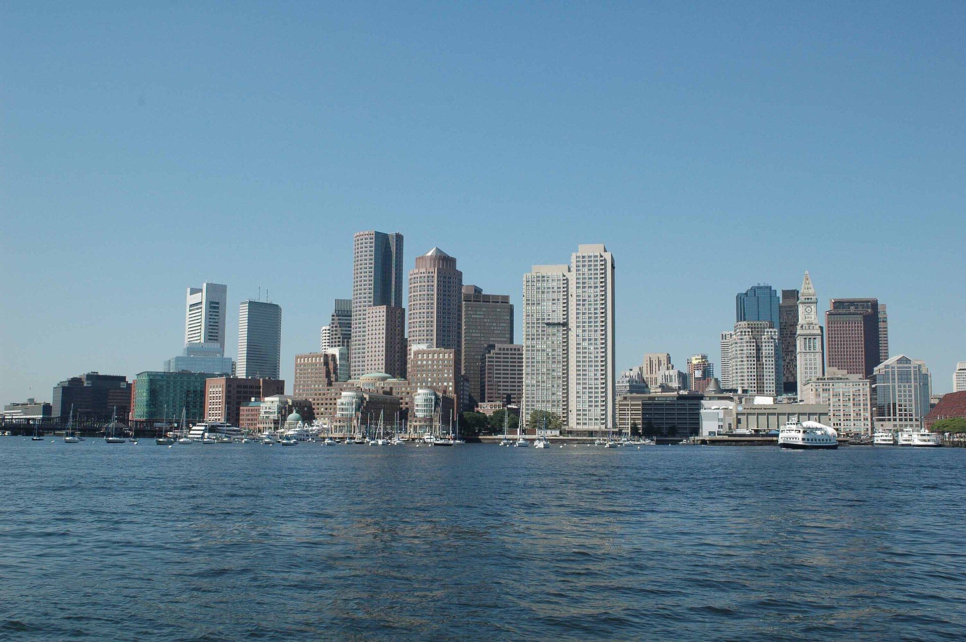
Stand on Long Wharf at seven in the morning and the water in front of you is clean enough to swim in, which is not a sentence anyone could have written in 1985. Boston harbor was, within living memory, one of the filthiest bodies of water in the United States — a federal court had to order the city to clean it — and the recovery is the single most impressive thing about Boston that almost no visitor is ever told. There are thirty-four islands out there, a national park nobody has heard of, a working lighthouse older than the country, and forty-three miles of public path along the edge.
This guide covers the islands and how to reach them, the ferries and what they cost, the Harborwalk, the waterfront neighborhoods, the boat trips worth taking and the ones that are not, and the story of how the water got clean. Prices and season dates were checked in September 2026; confirm before you travel, because almost everything on the water here is seasonal and the seasons move.
The short version
| What | Cost | Season | Verdict |
|---|---|---|---|
| Harbor Islands ferry (Georges, Peddocks, Spectacle) | $25 adult, $18 child 3–11, $23 senior, under 3 free — round trip | May to October | The best day on the water in Boston |
| MBTA harbor ferry, Long Wharf to Charlestown | Standard MBTA fare | Year-round | The cheapest boat ride in the city, and it is also transport |
| Whale watch from Central Wharf | Varies by operator | April to November | Excellent, and three to four hours on open water |
| Camping on Peddocks Island | Tent sites and yurts, booked ahead | Wed–Sun, 17 June – 12 October 2026 | The most unusual bed in Boston |
| The Harborwalk | Free | Year-round | Free, endless, and mostly empty |
| Deer Island loop trail | Free | Year-round | The best free harbor view in Greater Boston |
| Boston Duck Tours | $57 adult, $42 child, plus fees | Late March to the Sunday after Thanksgiving | No. See below |
Boston Harbor Islands: a national park almost nobody visits
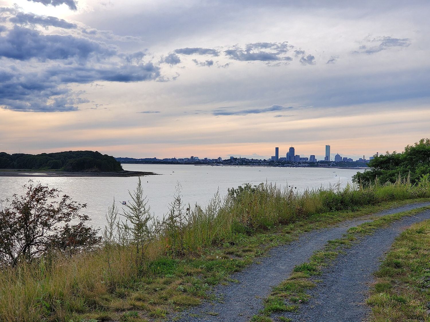
The Boston Harbor Islands National and State Park covers thirty-four islands and peninsulas, jointly run by the National Park Service, the Massachusetts Department of Conservation and Recreation, and the non-profit Boston Harbor Now. It is a genuine national park unit sitting in plain sight forty minutes from downtown, and on an ordinary weekday in June you can have a beach on it more or less to yourself.
Getting there: ferries, prices and the 2026 season
Ferries are operated by Boston Harbor City Cruises from Long Wharf North, next to the Aquarium and a two-minute walk from Aquarium station on the Blue Line. A round trip is $25 for adults, $18 for children aged 3 to 11, $23 for seniors over 65, and free for under-threes. Buy online, by phone on 617-227-4321, or in person at the Long Wharf North ticket center.
Public ferry service runs roughly May to October. In 2026, Georges Island service started on 15 May and the schedule expanded on 15 June to add Peddocks Island, with departures from Hingham as well as from Boston. Ferry service to Spectacle Island was unavailable at the start of the 2026 season because of repairs to the dock, running only from mid-July; the island itself stayed open throughout to anyone arriving by mooring, kayak or dinghy.
Two practical points. First, the last boat back is the last boat back; there is no other way off. Check the return times when you buy, not when you board. Second, the season ends around Indigenous Peoples’ Day weekend in October, so a November or April trip is not possible — a fact that catches out a great many people planning a shoulder-season visit. Current schedules are on bostonharborislands.org.
Georges Island and Fort Warren
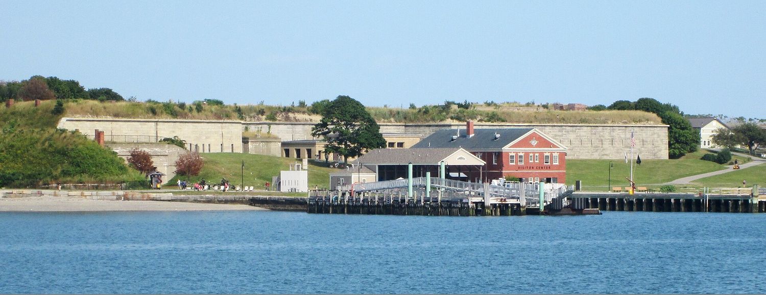
If you go to one island, go to this one. Georges Island is the ferry hub — boats to the other islands often connect here — and it holds Fort Warren, a granite coastal fortification begun in the 1830s and used as a Union prison during the Civil War. You can walk the ramparts, go down into the casemates, and get properly lost in unlit corridors that the Park Service leaves open on purpose. Bring a flashlight; the good bits are dark.
The island reopened on 15 May 2026 after water-main repairs closed it for a period. There is a visitor center, restrooms, a small snack concession, and a view back at the skyline that is the best free photograph in Boston. It is about a forty-minute crossing.
The fort has a ghost story attached — the Lady in Black, said to be the widow of a Confederate prisoner — and the rangers tell it well, which is exactly the right way to handle a ghost story: as folklore rather than as a claim.
Spectacle Island
The strangest island in the harbor. Spectacle was a rendering plant, then the city dump, then a capped landfill, and its two hills are built from spoil excavated during the Big Dig — the highest point in the harbor is made of Boston’s own basement. It now has a visitor center, a supervised swimming beach in season, five miles of walking trails and the best skyline view of the group.
Take the beach seriously as a reason to go. Swimming here is genuinely pleasant and the water is genuinely clean, which is the whole point of everything below in the cleanup section. Confirm ferry service before you plan around it, given the 2026 dock repairs.
Peddocks Island, and camping
Peddocks is the biggest island by shoreline, with the remains of Fort Andrews, a scatter of century-old private cottages held on life leases, and the only camping in the park. Camping runs Wednesday to Sunday, 17 June to 12 October 2026, with tent sites and — newly — yurts fitted with bunk beds and electricity. Reservations opened on 11 March 2026 and can be made up to four months before check-in.
Camping is not available on Bumpkin, Grape or Lovells in 2026, whatever older listings say. If you want a night on an island in Boston Harbor, Peddocks is the answer and you need to book it early — the yurts in particular go quickly.
The other islands
Thompson, Lovells, Bumpkin, Grape, Great Brewster and the rest range from occasionally served to accessible only by private boat. Lovells has a beach and the ruins of Fort Standish. Grape and Bumpkin are quiet and small and mostly reached from Hingham. Thompson has been used as an outdoor education campus. Unless you have your own boat or a specific reason, the three ferry-served islands are the park for practical purposes.
Boston Light
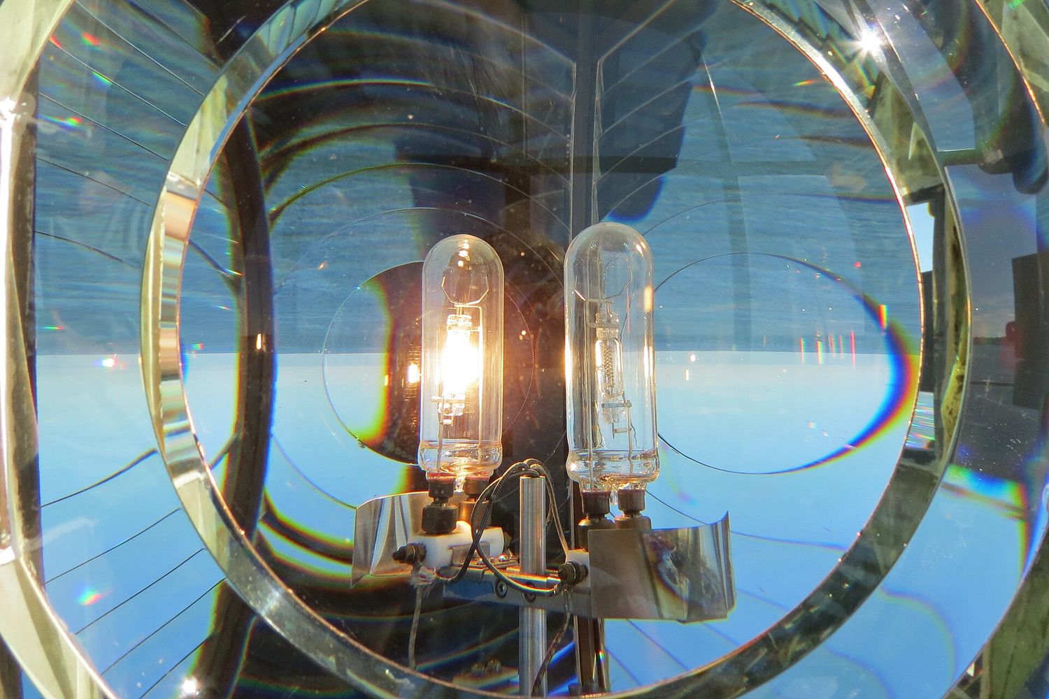
Boston Light stands on Little Brewster Island at the harbor mouth. The first lighthouse on the site dates from 1716, making it the oldest lighthouse station in the United States; the British blew up the original when they left in 1776 and the present tower went up in 1783. It is the last lighthouse in the country to keep an official keeper, a distinction written into federal law.
Landing tours to Little Brewster have run in some seasons and not in others, depending on the condition of the dock and the availability of Coast Guard support, so do not assume you can get onto the island — check with the park before you plan around it. What you can reliably do is see it from the water: harbor cruises and the Hull ferry pass close, and it is visible from the outer islands on a clear day.
Boats you can take without going to an island
The MBTA harbor ferry — the cheap one
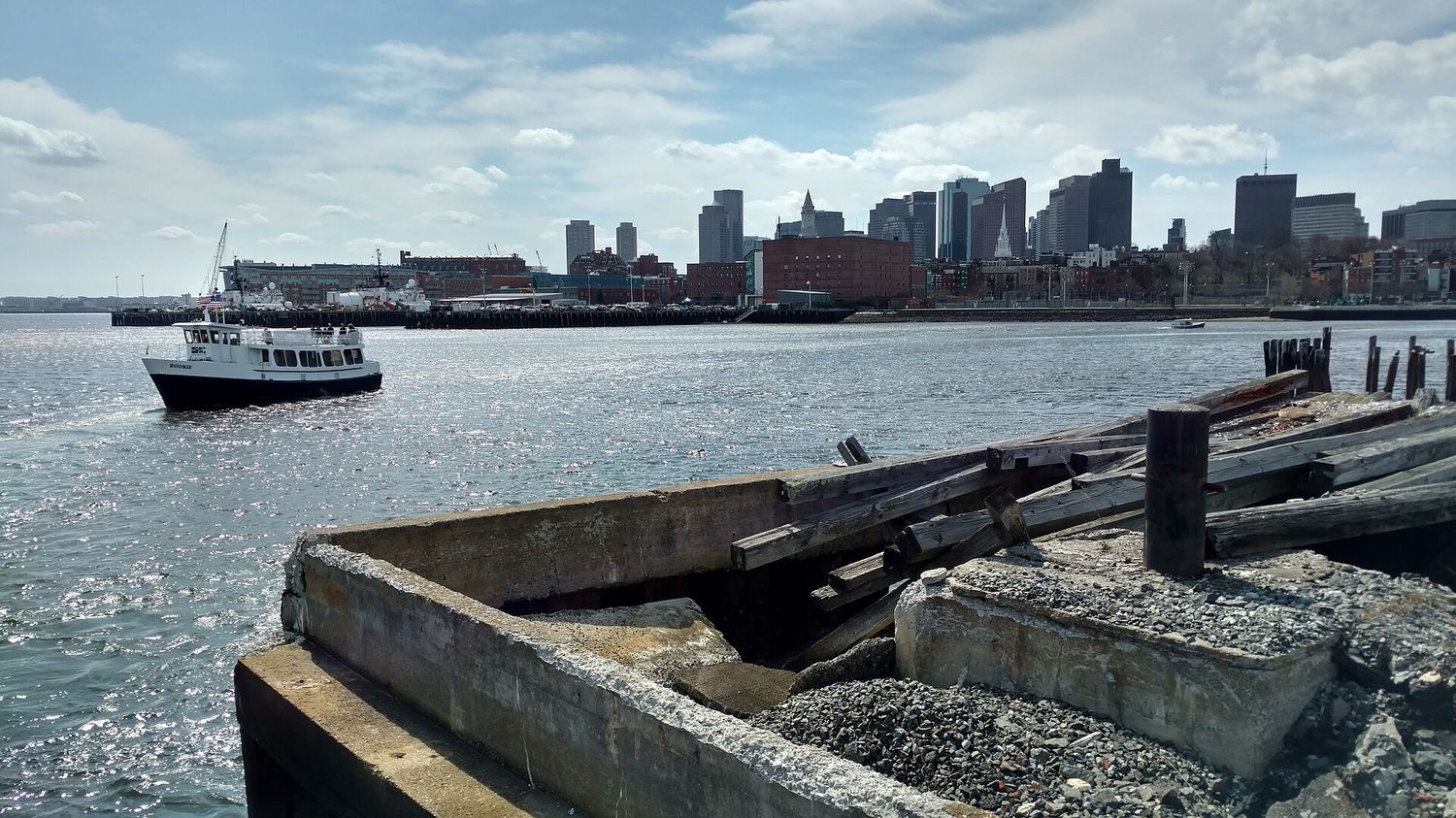
The Long Wharf to Charlestown Navy Yard ferry takes about ten minutes, costs a standard MBTA fare, and runs year-round. It is a commuter service rather than a tour, which is exactly why it is good: no commentary, no line, and it drops you at USS Constitution, which is free. One fare, a boat ride and an attraction. Fares and timetables are on mbta.com.
The MBTA also runs longer commuter routes to Hingham and Hull from Rowes Wharf and Long Wharf. The Hull boat in particular gives you a proper run down the harbor past the outer islands and Boston Light for a commuter fare, and the return leg into the city at dusk is one of the best hours in Boston. Most visitors never hear about it.
Whale watches
Boats leave from the New England Aquarium’s own dock on Central Wharf and run roughly April to November, going about thirty miles out to Stellwagen Bank, a submerged plateau at the mouth of Massachusetts Bay where the feeding is good. Trips take three to four hours.
Be honest with yourself about the conditions. This is open ocean, not the harbor; it can be cold and rough even in July, seasickness is common, and once you are an hour out there is nowhere to go. Take the medication before you board rather than after. Under those conditions, seeing a humpback breach at fifty yards is the best thing on this page.
Sightseeing cruises and sunset cruises
Several operators run narrated harbor cruises from Long Wharf and Rowes Wharf, typically ninety minutes, with sunset and cocktail variants in summer. They are pleasant and they are fine. The honest comparison: a Harbor Islands ferry costs $25 return and lands you on an island with a Civil War fort on it, while a narrated cruise costs more and lands you back where you started. If you want to be on the water and have limited money, take the ferry.
The Duck Tours, again
Boston Duck Tours costs $57 for an adult and $42 for a child aged 3 to 11, plus a 5% Convention Center fee and a $2 online booking fee. The water portion is roughly ten minutes on the Charles River, which is not the harbor at all. For a family of four that is over $210 for eighty minutes, and for that money you could take the Harbor Islands ferry twice and still have change. Children do like the splash-down. It is still bad value, and we are not going to pretend otherwise.
The Harborwalk
The Harborwalk is a continuous public path along the water’s edge, currently 43 miles of it, running from Logan Airport in East Boston through seven neighborhoods to the Neponset River, and planned to reach 47 miles when complete. It exists because Massachusetts law requires public access to the shoreline, and every waterfront development has had to build its stretch and keep it open.
It is the best free thing to do on the Boston waterfront and it is chronically under-walked. Some sections worth knowing:
- Long Wharf to Fan Pier — the tourist stretch, past the Aquarium, around Rowes Wharf’s arch, over the Fort Point Channel bridges into the Seaport. About a mile and a half, entirely flat, with the Institute of Contemporary Art cantilevered over the water at the far end.
- Fort Point Channel — old warehouse blocks, the Children’s Museum and its Hood milk bottle, and a working artists’ district that has survived the redevelopment better than anyone expected.
- East Boston, Piers Park — the best skyline view on the whole walk, straight across the inner harbor, reached by the Blue Line to Maverick. Almost no visitors go.
- Charlestown Navy Yard — USS Constitution, the Navy Yard’s granite dry docks, and the start of the Freedom Trail’s northern end.
- South Boston to Castle Island — the local stretch. Castle Island is not an island, is free, has Fort Independence and a two-mile loop, and is where South Boston goes on a Sunday.
One warning: the Harborwalk is continuous in law rather than in practice, and a few stretches route you inland around a building site or a working pier. Signage is inconsistent. Treat it as a series of excellent walks rather than one uninterrupted route, and our Boston neighborhoods guide has the context for each district it crosses.
Deer Island: the strangest good walk in Boston
Deer Island is not an island any more — a hurricane joined it to Winthrop in 1938 — and it holds the Massachusetts Water Resources Authority’s wastewater treatment plant, whose twelve egg-shaped digesters are visible from most of the harbor and from the air on the approach to Logan. It is also, improbably, a public park with a free loop trail of about two and a half miles around the perimeter, and it has the best unobstructed view of the harbor and the skyline anywhere on land.
The plant treats wastewater from 43 Greater Boston communities. It began partial operation in 1995 and reached full operation in 2000 when the outfall tunnel was completed — nine and a half miles long and twenty-four feet in diameter, carrying treated effluent out into deep water in Massachusetts Bay. It is the single reason you can swim off Spectacle Island.
Getting there needs a car or a bus to Winthrop; there is no ferry and no rapid transit. It is free, it is open daily, and there is nothing else in an American city quite like walking a coastal path around a sewage works and finding it beautiful.
How the harbor got clean
This is the part that is missing from almost every guide to the Boston waterfront, and it is the reason everything above is possible.
For most of the twentieth century Boston discharged inadequately treated sewage and, at times, raw sludge directly into the harbor. By the 1980s it was routinely described as the dirtiest harbor in America, beaches were closed for most of the summer, and the political will to fix it did not exist because the bill was enormous. In 1986 a federal court ordered the city to clean it up, and the Massachusetts Water Resources Authority was created to do the work.
What followed was one of the largest public works projects in the country: the Deer Island plant, the outfall tunnel, the closure of the sludge discharge, and decades of sewer separation across dozens of communities. Water quality improved to the point that the harbor beaches are now among the cleanest urban beaches in the United States, and the islands became a national park unit in 1996.
It cost billions and it appeared on Boston water bills for years, which is why locals of a certain age have complicated feelings about it. But it worked, comprehensively, and it is worth knowing when you are standing on a beach four miles from downtown wondering why the water looks like that. The Friends of the Boston Harborwalk have installed interpretive signs along the water that tell the story in more detail, and they are worth stopping to read.
A short history of the water
Boston exists because of this harbor. The Shawmut peninsula was chosen in 1630 for its deep, sheltered anchorage, and for two centuries the town’s entire economy came off the wharves — fish, timber, rum, molasses and, inseparably, the trade in enslaved people that the West Indies traffic depended on. Long Wharf, where the island ferries leave from today, once ran a third of a mile out into the harbor and was the point at which British troops landed in 1768 and from which they left in 1776.
The most famous night in the harbor’s history took place a few hundred yards south. On 16 December 1773, colonists threw 342 chests of East India Company tea into the water off Griffin’s Wharf, in a spot now buried under landfill near Fort Point Channel. The Boston Tea Party Ships and Museum recreates it on the channel with replica vessels and costumed interpreters, at $35 to $39 for adults and $26 for children aged 3 to 12 with timed entry and peak-day pricing. It is theatrical rather than scholarly, and children between about six and twelve enjoy it a great deal more than adults expecting a museum.
The immigration harbor
Through the nineteenth century Boston was a major immigration port, and the arrival experience was harder than the Ellis Island version most people picture. Deer Island held a quarantine station and hospital where thousands of Irish famine migrants died in 1847 alone; a memorial on the island marks it, and it is one of the quieter and more affecting things on the harbor. East Boston’s wharves handled the Cunard line and later waves of Italian, Jewish and, more recently, Central and South American arrivals — which is why the neighborhood eats the way it does today.
Long before any of that, the islands and the shoreline were Massachusett land, and the harbor’s Indigenous history is one the park has been steadily better at telling. The Boston Harbor Islands park now interprets it explicitly, which is a recent and welcome change.
Shipbuilding, decline and reinvention
The Charlestown Navy Yard built and repaired warships from 1800 until it closed in 1974, and its granite Dry Dock 1 — one of the first in the country, opened in 1833 — held USS Constitution for her first docking. When the yard closed, the Seaport was still parking lots and railway sidings, the fishing fleet had shrunk, and the harbor was too polluted to swim in. Everything you can now do on this page dates from the four decades since.
Getting on the water yourself
You do not need an operator to be on the harbor, and the options are cheaper than the cruises.
Kayaking and paddleboarding
Rental operations run seasonally on the Charles River, in the Seaport and from East Boston, and there is a designated Boston Harbor water trail linking launch points around the inner harbor and out to some of the islands. The inner harbor is busy with ferries, water taxis and commercial traffic, so this is not a beginner’s paddle — take a guided trip the first time. Season is roughly May to October.
Community sailing
Community Boating on the Charles River Esplanade has been putting people on the water at a low cost since the 1930s and is one of the oldest public sailing programs in the country. Courageous Sailing operates out of the Charlestown Navy Yard on the harbor itself. Both run short memberships that make sense for a longer visit, and both cost a fraction of what a private charter does.
Water taxis
On-demand water taxis run between the airport, Long Wharf, Rowes Wharf, the Seaport and the Navy Yard. They cost more than the ferry and less than a private boat, and the airport run in particular is a genuinely good arrival into Boston — you land, you walk to the dock, and ten minutes later you are stepping off at your hotel with the skyline in front of you. Confirm the operator is running and the dock is open before you count on it late at night.
Castle Island and Pleasure Bay
At the South Boston end of the Harborwalk, Castle Island is free, open year-round, and holds Fort Independence, a granite fort on a site fortified since 1634. The loop around Pleasure Bay is about two miles, entirely flat, and has planes lining up over the water for Logan the whole way round. Sullivan’s, the takeout window by the fort, has been there since 1951 and is an institution rather than a restaurant. This is the most local thing on this page and it costs nothing.
The waterfront neighborhoods
The Seaport
Twenty years ago this was parking lots. It is now the densest new development in Boston, with the Institute of Contemporary Art, the convention center, a great deal of glass, and more restaurants per acre than anywhere else in the city. The honest verdict: it is convenient, it is comfortable, the harbor views are real, and it has almost no character. It is windy in a way that has to be experienced, and it is bleak in February. Stay here for space and newness, not for atmosphere.
The Institute of Contemporary Art
The one building in the Seaport that justifies the trip on its own. Opened in 2006, it cantilevers its top-floor gallery out over the water on a steel truss, and the Founders Gallery at the end is a glass room facing nothing but harbor — a piece of architecture that makes the view part of the collection. Admission is $20 for adults, $17 for seniors and $15 for students, free for under-18s, and it is free for everyone on Thursday evenings from 5pm to 9pm. It is closed Mondays.
The ICA also runs the Watershed, a seasonal second space in a former condiment warehouse in East Boston, reached by a short shuttle boat from the museum’s own dock in summer. Included with admission when it is open, it is one of the few museum experiences anywhere that requires a boat, and it puts you in a part of the harbor most visitors never see. Our Boston museums and culture guide has the rest of the city’s collections.
The North End waterfront and Christopher Columbus Park
Between Long Wharf and the North End, Christopher Columbus Park has a wisteria-covered trellis, a small harbor beach view and a playground, and it is where the historic city meets the water. Five minutes’ walk inland puts you on Hanover Street. This is the best-positioned stretch of waterfront in Boston and it is free.
East Boston
Across the inner harbor, reached by the Blue Line in four minutes or by ferry. Piers Park has the skyline view, the neighborhood has the best Latin American food in the city, and it costs meaningfully less than anywhere across the water. It is the most underrated place to stay in Boston, with the caveat that you will hear the airport.
Charlestown
The Navy Yard, USS Constitution, the Bunker Hill Monument’s 294 steps, and one of the oldest residential districts in the city behind it. The ferry from Long Wharf is the nicest way in. Our Freedom Trail guide covers the historic sites here in full.
Beaches and swimming
Boston has city beaches, they are on the Red Line, and visitors almost never use them. Carson Beach, M Street Beach and Pleasure Bay in South Boston are a short walk from JFK/UMass or Broadway, are free, are lifeguarded in season, and are genuinely clean. Constitution Beach in East Boston is on the Blue Line with planes landing overhead, which children find fascinating.
Spectacle Island has the only supervised beach on the islands. Water temperature is the constraint rather than water quality: the harbor peaks somewhere in the high sixties Fahrenheit in August, which is bracing rather than warm. July and August are the realistic swimming months.
What a harbor day costs
| Day | Two adults | Family of four | Notes |
|---|---|---|---|
| Georges Island by ferry | $50 | $86 | Take a picnic; the concession is limited |
| Charlestown ferry and USS Constitution | Two MBTA fares | Four MBTA fares | The ship and its museum are free; museum donation suggested |
| Harborwalk from Long Wharf to the Seaport | $0 | $0 | Add $20 each for the ICA if you go in |
| Deer Island loop | $0 plus transport | $0 plus transport | Needs a car or a bus to Winthrop |
| Whale watch | Operator pricing | Operator pricing | Three to four hours; take seasickness medication first |
| Peddocks camping | Site or yurt fee plus $50 ferry | Site or yurt fee plus $86 ferry | Wed–Sun only, 17 June – 12 Oct 2026 |
| Duck Tour | Over $120 with fees | Over $210 with fees | Ten minutes of it is on water, and that water is the Charles |
A harbor day that works
Take the 10am ferry from Long Wharf North to Georges Island with a packed lunch. Walk the ramparts of Fort Warren, go down into the dark casemates with a flashlight, eat on the grass looking at the skyline, and take a mid-afternoon boat back. You are on Long Wharf by four with the Aquarium’s seals visible for free from the plaza and the North End ten minutes’ walk away for dinner. Total cost for two adults: $50 plus the food.
If the islands are out of season, the substitute is the Charlestown ferry, USS Constitution and its free museum, the walk back over the Charlestown Bridge into the North End, and the Harborwalk south from Long Wharf to the Seaport in the late afternoon. That version costs two MBTA fares. Our Boston itinerary guide fits both into longer plans.
Practical notes for the water
- It is colder on the water. Ten degrees colder than the city is normal, and the wind on an open ferry deck in October is not a joke. Take a layer more than you think.
- Take a flashlight to Georges Island. The best parts of Fort Warren are unlit tunnels.
- Take water and food to the islands. Concessions are limited and sometimes closed. There is drinking water on the served islands but do not rely on buying lunch.
- Check the last boat. There is no other way back, and the schedule is not the same every day of the week.
- Sun exposure is worse on water. The islands have very little shade.
- Accessibility varies by island. Georges and Spectacle have the best provision; the outer islands have rough ground and no facilities. Contact the park in advance if this matters.
Frequently asked questions
How do you get to the Boston Harbor Islands?
By ferry from Long Wharf North, next to the New England Aquarium and two minutes from Aquarium station on the Blue Line. Boston Harbor City Cruises operates the service; a round trip is $25 for adults, $18 for children aged 3 to 11 and $23 for seniors, with under-threes free. Service runs roughly May to October.
Which Boston Harbor island is best?
Georges Island, for Fort Warren — a granite Civil War-era fort with ramparts you can walk and dark casemates you can explore. Spectacle Island is the best for swimming and for the skyline view, and Peddocks is the one with camping.
Can you camp on the Boston Harbor Islands?
Only on Peddocks Island, Wednesday to Sunday from 17 June to 12 October 2026, in tent sites or in yurts with bunk beds and electricity. Reservations opened on 11 March 2026 and can be made four months ahead. Camping is not available on Bumpkin, Grape or Lovells in 2026.
Is Boston Harbor clean enough to swim in?
Yes. A 1986 federal court order forced a cleanup that produced the Deer Island treatment plant and a nine-and-a-half-mile outfall tunnel, and the harbor beaches are now among the cleanest urban beaches in the country. Water temperature, not water quality, is the limiting factor — it peaks in the high sixties Fahrenheit in August.
Can you visit Boston Light?
Not reliably. Landing tours to Little Brewster Island have run in some seasons and not others, depending on the dock and on Coast Guard support, so check with the park rather than assuming. You can always see it from the water — harbor cruises and the Hull commuter ferry pass close by.
What is the cheapest boat ride in Boston?
The MBTA ferry from Long Wharf to the Charlestown Navy Yard: about ten minutes on a standard MBTA fare, year-round, and it delivers you to USS Constitution, which is free to board. The longer MBTA commuter boats to Hingham and Hull are the same idea at a bigger scale.
What is the Boston Harborwalk?
A continuous public path along the water’s edge — 43 miles of it built so far, from Logan Airport through seven neighborhoods to the Neponset River, with 47 miles planned. It is free, it exists because Massachusetts law requires public shoreline access, and it is the most under-used good thing on the Boston waterfront.
Are the Boston Duck Tours a good way to see the harbor?
No, and they do not go into the harbor — the water section is on the Charles River. At $57 adult and $42 child plus fees, they are the most expensive eighty minutes in Boston. A Harbor Islands ferry is $25 return and puts you on an island with a Civil War fort on it.
When does the Harbor Islands ferry season start and end?
Roughly mid-May to Indigenous Peoples’ Day weekend in October. In 2026 Georges Island service began on 15 May and expanded on 15 June to include Peddocks. There is no winter, early spring or late fall service.
Where is the best free view of Boston Harbor?
Deer Island’s perimeter loop trail in Winthrop, which is free, open daily and about two and a half miles round. Piers Park in East Boston is the best free view of the skyline across the inner harbor and is four minutes from downtown on the Blue Line.