Stand at the top of Beacon Hill and you are on one of the three original hills of a peninsula that was, in 1630, about eight hundred acres of pasture connected to the mainland by a strip of land so narrow that high tides sometimes covered it. Almost everything you can see from up there is invented ground. Understanding Boston neighborhoods starts with that fact, because it explains why the North End’s streets wander like cow paths while Back Bay runs on an alphabetical grid, and why two districts a quarter of a mile apart can feel three hundred years distant.
This guide covers every neighborhood a visitor might reasonably want to understand — the central ones you will walk through, the inner ring you should make time for, and the outer ones where most Bostonians actually live and almost no tourists go. It is about what each place is, rather than where to book a room; for that, see our separate guide to where to stay in Boston. Details were checked in September 2026.
How Boston Is Actually Put Together
Two processes made the modern city, and both are visible on the ground.
Filling. Boston has roughly tripled its land area by dumping gravel into water. The South End went in from the 1830s. Back Bay — literally a tidal bay, and badly polluted by the middle of the century — was filled between 1857 and the 1890s, using trainloads of gravel from Needham, and laid out on a French-inspired grid because it was designed all at once. The waterfront, the Seaport, East Boston and much of Charlestown are all made land. The result: where the streets are straight, the ground is young. Where they wander, you are on the original peninsula.
Annexation. The city swallowed its neighbors in the nineteenth century — Roxbury in 1868, Dorchester in 1870, Charlestown, Brighton and West Roxbury in 1874, Hyde Park in 1912. Each arrived with its own center, its own main street and its own identity, which it has largely kept. This is why Boston does not feel like one city radiating from a downtown but like a dozen small towns that ran into each other. Brookline, offered the same deal in 1873, said no, and remains an independent town entirely surrounded by Boston to this day.
The other thing worth knowing before you start: Boston is small. The whole city is about 48 square miles, and its population is a little under 700,000 — smaller than most people expect for a place with this much cultural weight. You can cross the central neighborhoods on foot in an afternoon.
How to Read a Boston Street
Boston is unusually legible if you know the building types, because each one belongs to a period and a place. Five will get you most of the way.
- Federal (roughly 1790–1830): flat brick fronts, a fanlight over the door, restrained detail, often a shallow bow. Beacon Hill and Charlestown are full of them. Charles Bulfinch is the name attached, and the State House is his.
- Greek Revival (1830s–1840s): heavier, with columns and pediments and granite. Much of Charlestown’s rebuilt housing stock, and the older parts of the South End.
- Bowfront row house (1840s–1870s): the South End’s signature — brick, a curved projecting front, and a high stone stoop up to the parlor floor. Built in speculative runs of a dozen at a time.
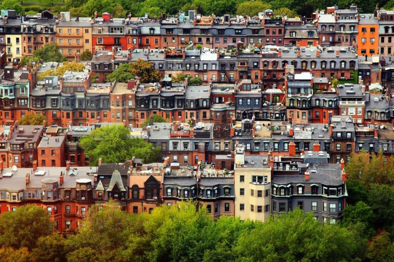
- Brownstone and Victorian eclectic (1860s–1890s): Back Bay. Sandstone rather than brick, mansard roofs, bay windows, and each block a slightly different set of architectural ideas, because Back Bay went up while fashions were changing fast.
- Triple-decker (1880s–1920s): three wooden stories, one flat each, stacked back porches. The building type of the outer neighborhoods, and the reason Dorchester, Somerville and Roxbury look the way they do.
One more, worth knowing by name: Richardsonian Romanesque, invented here by H. H. Richardson in the 1870s — massive rough stone, deep round arches, squat towers. Trinity Church in Copley Square is the definitive example, and once you have seen it you will start noticing its imitators on library and church fronts across the country.
The practical use of all this: the building tells you when the ground under it was made. Wandering streets with Federal brick means original peninsula. Straight streets with brownstone means filled bay. Wide streets with triple-deckers means an annexed town that grew when the streetcars arrived.
The Central Neighborhoods
Beacon Hill
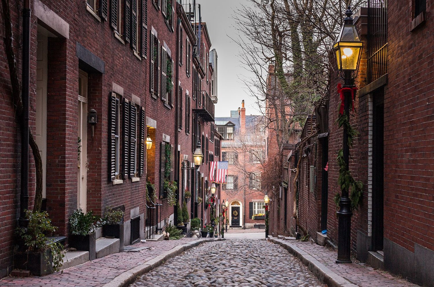
The postcard: gas lamps, brick sidewalks heaved by tree roots, black shutters, and Acorn Street, which is probably the most photographed lane in America. Built from about 1795 on land that belonged to the painter John Singleton Copley, on one of the three hills the Puritans found here — the other two were levelled and used as fill.
The south slope, facing the Common, was the address of the Brahmin establishment. The north slope was something more remarkable: through the nineteenth century it held the largest free Black community in the city, and it became the organizational center of American abolitionism. The Black Heritage Trail runs 1.6 miles through it, ending at the African Meeting House of 1806 — the oldest surviving Black church building in the country, where William Lloyd Garrison founded the New England Anti-Slavery Society and where the 54th Massachusetts was recruited. National Park Service rangers lead it free in season, and it is the single most rewarding walk in Boston that most visitors never take.
Don’t miss: the purple window panes at 63–64 Beacon Street, from a bad batch of nineteenth-century glass that turned violet in sunlight; the Nichols House Museum; Charles Street at the foot of the hill for antiques and coffee.
Back Bay
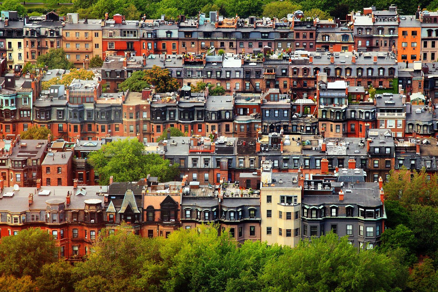
The most coherent piece of urban design in the city, and the youngest of the central neighborhoods. Because it was filled and built in one continuous program, it has a plan: Commonwealth Avenue with its tree-lined central mall down the middle, Marlborough and Beacon quiet and residential on the river side, Newbury and Boylston commercial on the other, and the cross streets running alphabetically from Arlington through Berkeley, Clarendon, Dartmouth, Exeter, Fairfield, Gloucester to Hereford.
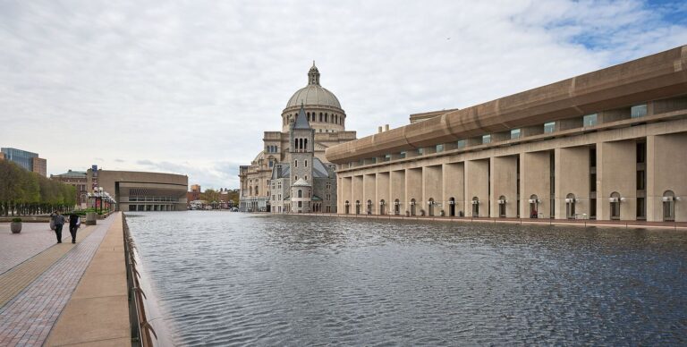
Copley Square is the set piece: H. H. Richardson’s Trinity Church of 1877 facing McKim, Mead & White’s Boston Public Library of 1895, with the glass slab of the Hancock Tower reflecting both. The library is free, and Bates Hall — a 218-foot barrel-vaulted reading room — is one of the great interiors in America.
Don’t miss: the Sargent murals on the library’s third floor; the Commonwealth Avenue Mall in fall; the view from View Boston on the Prudential’s 52nd floor, $34 plus a $3 fee, open daily to 10pm.
The North End
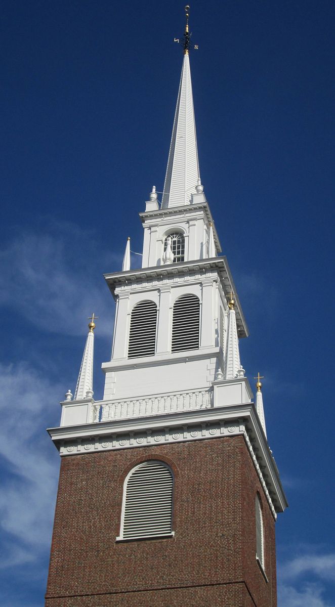
Boston’s oldest continuously inhabited neighborhood, and the densest. Its streets follow the shape of a seventeenth-century waterfront, which is why they make no sense. Paul Revere’s house on North Square, built around 1680, is the oldest surviving house in downtown Boston; Old North Church, 1723, is the oldest surviving church building in the city.
It has been, in sequence, Puritan, then home to a substantial free Black population, then Irish, then Jewish, then — from the 1880s — Italian, and it is the Italian layer that stuck. Around a hundred restaurants, several bakeries that never close, and a run of summer feasts on saints’ days that are genuine neighborhood events rather than performances.
Don’t miss: Copp’s Hill Burying Ground for the free view over the water; the plaque near Commercial Street marking the Great Molasses Flood of 15 January 1919, when a burst storage tank sent a wave of molasses through the streets and killed twenty-one people.
Downtown, the Financial District and the West End
The commercial core, and the place where Boston’s history is most tangled up with its office blocks. The Old State House of 1713 stands at a downtown intersection completely surrounded by towers, with a subway entrance running through it. Downtown Crossing is the pedestrianized shopping district; the Financial District behind it is glass and granite and empties on weekends.
The West End deserves a paragraph of its own, because it is a cautionary tale. This was a dense, poor, largely Italian and Jewish neighborhood of about 7,000 people until the late 1950s, when urban renewal levelled roughly fifty acres of it and replaced it with towers and a plaza. The residents were dispersed and the community never re-formed. It is now widely taught as one of the clearest examples of how not to renew a city, and the small West End Museum tells the story from the inside.
Chinatown and the Theater District
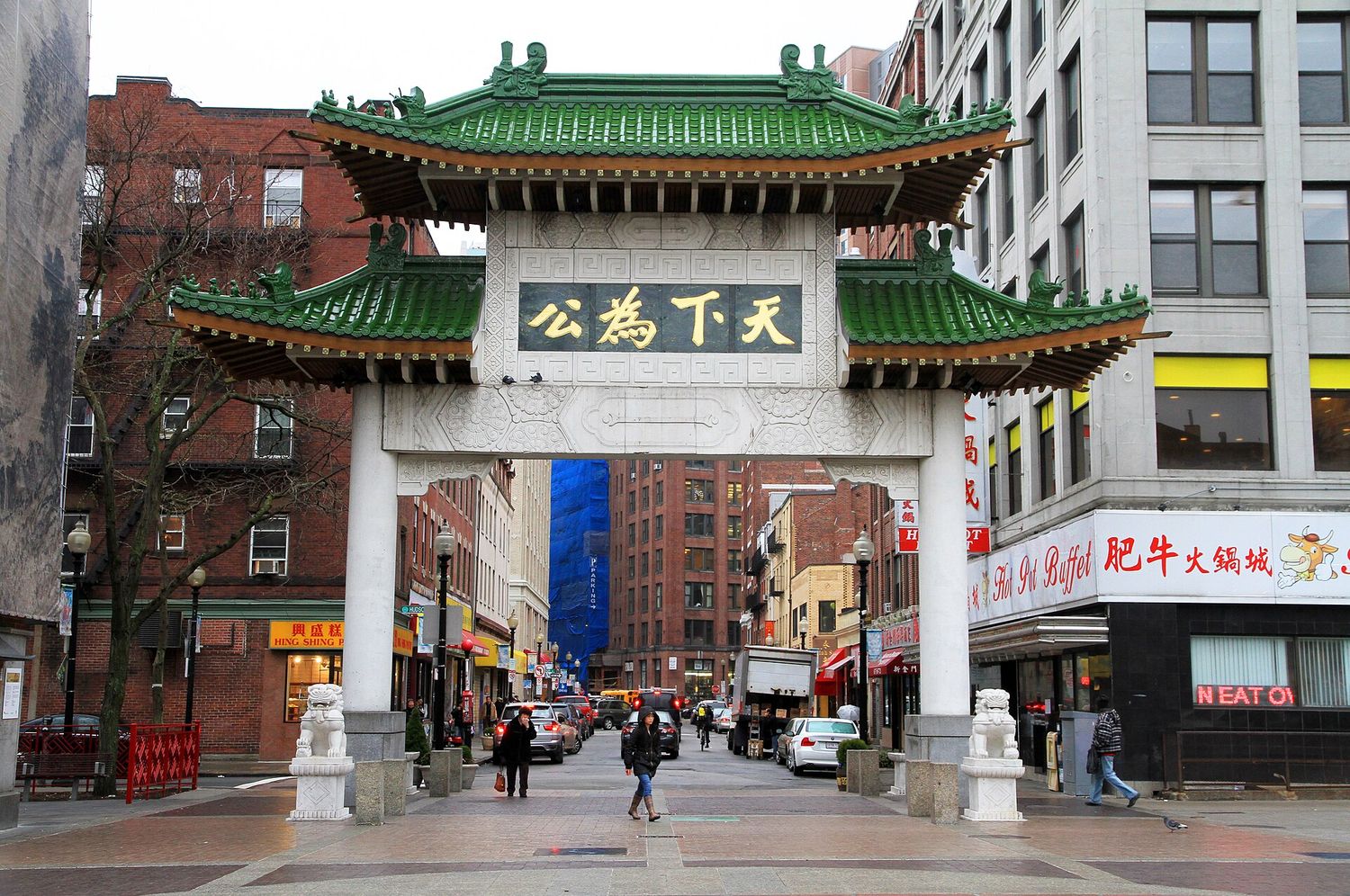
One of the last remaining Chinatowns on the American East Coast, and by some distance the densest few blocks in New England. Chinese immigrants arrived in the 1870s, the community consolidated around Beach and Tyler Streets, and it has since absorbed Vietnamese, Cambodian and Taiwanese arrivals as well. It is small — squeezed by the Massachusetts Turnpike on one side and downtown development on the other — and it has spent decades fighting to stay where it is.
The Theater District next door holds the big restored houses on Tremont and Washington. It is loud, it is not pretty, and it has the best late-night eating in the city.
The South End
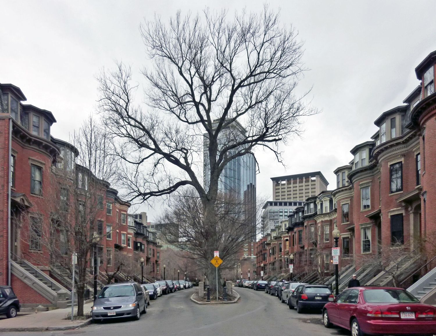
Filled and laid out a generation before Back Bay, on a different model: bowfront brick row houses arranged around small English-style garden squares — Union Park, Rutland Square, Worcester Square. It is the largest intact Victorian row-house district in the country and it is designated a National Historic Landmark for exactly that reason.
Its social history is a genuinely Boston story. Built for the middle class, abandoned by them for Back Bay within a generation, converted into rooming houses, and for much of the twentieth century a poor, mixed, heavily Black, Lebanese, Greek and Puerto Rican district with a major jazz scene along Columbus Avenue and Massachusetts Avenue. From the 1970s it became the center of Boston’s LGBTQ+ community, and it gentrified hard. All of those layers are still visible if you look at who is on which block.
Don’t miss: Union Park on a spring morning; the SoWa district’s Sunday open market from roughly June to October; the restaurant strip along Tremont and Washington, which is the best in the city.
The Seaport and Fort Point
Twenty years ago this was surface parking and cold storage. It is now the densest concentration of new construction in New England: glass towers, wide sidewalks, and the Institute of Contemporary Art cantilevered out over the water. Whether it is a neighborhood yet is a live argument in Boston, and the answer is probably not.
The criticism is worth stating plainly, because it is the most-discussed piece of city-building in Boston in a generation: the district was developed fast, on public land, with very little affordable housing, and for years it was noticeably one of the least racially diverse parts of a majority-minority city. It is also built at sea level on filled ground in a harbor with rising water, and the engineering that will be needed to keep it dry is a live municipal argument. None of that stops the harbor views from being excellent on a summer evening — but it is why a lot of Bostonians roll their eyes when a visitor calls it their favorite neighborhood.
Fort Point, just inland along the channel, is the interesting half. Nineteenth-century wool warehouses with enormous windows, colonized by artists in the 1970s and now home to one of the larger artist communities in the country, plus the Children’s Museum and a run of good bars. Walk this rather than the waterfront.
The Inner Ring
Charlestown
Across the river and technically the oldest part of the settlement — it was settled in 1629, a year before Boston proper. Burned to the ground by British artillery during the Battle of Bunker Hill in 1775 and rebuilt, which is why its housing stock is Federal and Greek Revival rather than colonial.
It is steep, handsome, quiet and famously insular; people born here call themselves Townies and mean it. The Navy Yard at the bottom of the hill holds USS Constitution, and the MBTA ferry from Pier 4 to Long Wharf is the most pleasant ten-minute journey in the city.
South Boston
“Southie.” Historically Irish, historically working class, and for a long time the most tightly bounded community in the city. It has changed enormously in twenty years — the closer to the Seaport, the more it has changed — and there is real friction about that.
For a visitor it is mostly about the water. Castle Island at the eastern tip is not an island any more but holds Fort Independence, a granite star fort, with a loop walk around Pleasure Bay, planes coming in low over the water, and a seasonal shack that has been selling hot dogs and fried clams since 1951. Carson and M Street beaches are real city beaches, and on a hot day they are full.
East Boston
Built by joining five separate islands together with fill in the nineteenth century, and now home to Logan Airport and the largest Latin American community in the city — Salvadoran, Colombian, Honduran, Mexican. One stop on the Blue Line from downtown.
Piers Park, on the harbor, has the best skyline view in Boston, straight across the water at the Financial District, and it is free and almost always quiet. The eating along Meridian Street is excellent and cheap.
Fenway–Kenmore and Longwood
Three things share this ground: a ballpark, two world-class museums, and one of the largest concentrations of hospitals and medical schools on earth. The Back Bay Fens that gives the area its name is an Olmsted park, part of the Emerald Necklace, and holds the Fenway Victory Gardens — plots dug for food during the Second World War and cultivated continuously ever since.
The Museum of Fine Arts ($30 adult, $14 child 7–17, closed Tuesdays) and the Isabella Stewart Gardner Museum ($25 adult, free under 18, closed Tuesdays, free Thursday 5–9pm) are a five-minute walk apart. Fenway Park tours run $30 adult and $21 child 3–12.
Kenmore Square itself is worth a stop for one reason: the Citgo sign, a 60-foot neon triangle on a rooftop that has been there since 1965, is visible over the Green Monster from inside Fenway Park, and was granted protection after a public campaign to save it. It is the least likely landmark in Boston and the city is completely serious about it.
Mission Hill
Steep, student-heavy and dominated by the twin towers of the Mission Church basilica, visible from a surprising distance. Cheap food, a strong Latin American presence, and one of the more genuinely mixed neighborhoods in the city. Not a sightseeing destination, but a good walk between the Fenway museums and Jamaica Plain.
Allston and Brighton
Student Boston. Allston in particular is where a large share of the region’s undergraduates and recent graduates live, which gives it cheap late-night Korean, Japanese and Chinese food, the best small music venues in the city, and a distinctive local ritual: Allston Christmas, on and around 1 September, when the vast majority of leases turn over on the same day and the sidewalks fill with abandoned furniture. The moving trucks get stuck under the Storrow Drive bridges with such regularity that the verb “storrowed” is in local use.
Brighton, next door, is quieter and more residential, with a large Russian-speaking and Orthodox Jewish population around Washington Street and Brighton Center. Both sit on the Green Line B branch, which is the slowest ride in the system — thirty stops in four miles — so allow more time than the map suggests.
The Outer Neighborhoods
This is where most of Boston actually lives, and where essentially no visitor goes. If you have five days or more, one afternoon out here will teach you more about the city than another museum.
Jamaica Plain
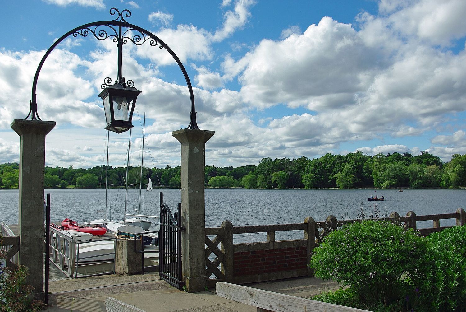
The most appealing outer neighborhood for a visitor, and the greenest part of the city. Three links of Olmsted’s Emerald Necklace run through it: Jamaica Pond, a glacial kettle hole and the largest fresh water in Boston, with a walking loop and a boathouse; the Arnold Arboretum, 281 acres run by Harvard, free, open every day, and on a clear morning in May or October the best thing in the city that nobody visits; and Franklin Park, the largest of them, with the zoo and a golf course.
Centre Street through the middle has bookshops, Cuban and Dominican food, a long-standing Latin American community and a long-standing radical political streak. Orange Line to Green Street or Forest Hills.
Roxbury
The historic heart of Black Boston and the geographic center of the city. Founded in 1630 — as old as Boston itself — annexed in 1868, and transformed in the mid-twentieth century as the Great Migration and then decades of redlining and disinvestment reshaped who lived where.
Nubian Square, renamed from Dudley Square in 2019 after a community campaign, is its center. Malcolm X spent his teenage years at 72 Dale Street, in a house his family owned; it has been the subject of a long restoration effort. The Museum of the National Center of Afro-American Artists sits in a Gothic Revival mansion on Walnut Avenue, and Fort Hill’s Highland Park gives you a view over the whole city from the spot where Washington’s artillery once looked down on the British.
Dorchester
The largest neighborhood in Boston by both area and population — around a fifth of the entire city — and one of the most diverse places in New England. Vietnamese along Dorchester Avenue, Cape Verdean, Haitian, Irish, Jamaican and Dominican communities in different pockets, and the triple-decker as the defining building type: a three-story wooden house with one flat per floor, invented here and built by the thousand.
For visitors: the JFK Presidential Library and Museum at Columbia Point, in an I. M. Pei building on a spit of land with water on three sides, is excellent and consistently underrated. The Dorchester Heights monument in the adjacent part of South Boston marks where Washington’s guns, dragged overland from Ticonderoga, forced the British to evacuate the city on 17 March 1776 — still a public holiday in Suffolk County.
Roslindale, West Roxbury, Hyde Park and Mattapan
The far southwest. Roslindale Village has become a quietly good small high street with a farmers market and a strong food scene. West Roxbury is leafy and suburban. Hyde Park, annexed last in 1912, still feels like a separate town. Mattapan has the largest Haitian community in Massachusetts and is served by the Mattapan High Speed Line, a short trolley route that ran vintage PCC streetcars from the 1940s for decades — a genuine piece of working transit history.
These are residential neighborhoods with nothing built for tourists in them, which is precisely the point of mentioning them.
Across the River and Over the Line
Three places that are not Boston but that visitors treat as though they are.
Cambridge is a separate city of about 120,000 people, containing Harvard and MIT. Harvard Square is the tourist one; Central Square is scruffier and has the music; Inman Square has the food; Kendall is glass towers and biotech. The Harvard Art Museums have been free to everyone since 2023, which makes them the best-value serious museum in the region.
Somerville, north of Cambridge, is denser than Boston itself and was for a long time a working-class Irish, Italian and Portuguese city that has changed dramatically since the Green Line extension reached it. Davis Square and Union Square are the centers.
Brookline is a town, not a neighborhood, and the reason Boston has an odd bite taken out of its map: it refused annexation in 1873 and has stayed independent ever since. Coolidge Corner is a genuinely lovely main street with an art deco cinema, and John F. Kennedy was born at 83 Beals Street, now a National Park Service site.
The Part Boston Does Not Put on Postcards
Any honest neighborhood guide to this city has to say something about how sharply divided it has been, because it explains the map.
Twentieth-century redlining and lending practices concentrated Black Bostonians in Roxbury, North Dorchester and Mattapan and kept them out of other neighborhoods. When a federal court ordered school desegregation by busing in 1974, the resistance — particularly in South Boston and Charlestown — was violent, sustained and nationally televised, and it left a reputation the city spent decades living down and a mistrust that has not entirely gone.
Boston today is a majority-minority city with an enormous immigrant population, and the neighborhood boundaries are far more porous than they were. But it is still a place where people identify themselves by a five-block area, where the difference between the South End and South Boston is not a matter of geography but of history, and where a wealth gap between neighborhoods a mile apart is among the widest in the country. Knowing that will make what you see on a walk through Roxbury or Southie legible rather than puzzling.
Which Neighborhoods Are Worth Your Time
| Neighborhood | Give it | Go for | Getting there |
|---|---|---|---|
| Beacon Hill | 2 hours | Acorn Street, the Black Heritage Trail | Charles/MGH, Park St |
| North End | Half a day | Food, Revere House, Old North, Copp’s Hill | Haymarket, North Station |
| Back Bay | Half a day | The library, Newbury St, Comm Ave Mall | Copley, Arlington, Hynes |
| South End | 2–3 hours | Row houses, Union Park, dinner | Back Bay, Silver Line |
| Chinatown | 1–2 hours | Dim sum, the gate, late food | Chinatown, Boylston |
| Charlestown | Half a day | USS Constitution, Bunker Hill, the ferry | Community College, ferry |
| Jamaica Plain | Half a day | The Arboretum, Jamaica Pond, Center St | Forest Hills, Green St |
| Cambridge | A full day | Harvard Yard, free art museums, the river | Red Line |
| South Boston | 2–3 hours | Castle Island, the beaches | Broadway, then a walk |
| East Boston | 2 hours | Piers Park view, Latin American food | Maverick, Blue Line |
| Dorchester | Half a day | JFK Library, Dot Ave food | JFK/UMass, Fields Corner |
| Roxbury | 2–3 hours | Nubian Square, Highland Park, the AAMARP museum | Nubian, Roxbury Crossing |
| Seaport | 1–2 hours | The ICA, Fort Point warehouses | Silver Line, or walk |
The Neighborhoods Visitors Get Wrong
A short list of confusions that come up constantly, gathered in one place.
- The North End is not near North Station’s neighborhood in name only — it is, confusingly, in the north of the original peninsula, while the South End is not the southern end of anything much and the West End was mostly demolished. The compass names date from a much smaller city.
- Cambridge is not part of Boston. It is a separate city with its own mayor, police and schools, and residents are firm about this. The same goes for Somerville and Brookline.
- “Downtown Boston” is not where most things are. The museums are in the Fenway, the food is in the North End and the South End, the universities are across the river. Downtown is offices and the Freedom Trail.
- Fenway is a neighborhood, the Fens is a park, and Fenway Park is a ballpark — all three within a few hundred yards, all three routinely confused.
- Roxbury and Roslindale and West Roxbury are three different places. So are Dorchester and Dedham. Boston’s naming is not helping anyone.
- The Seaport, the Waterfront, Fort Point and the Innovation District are overlapping names for roughly the same area, applied inconsistently by developers, the city and everyone else.
Three Walks That Link Them Up
The old city, about 3 miles. Boston Common, up over Beacon Hill, down Charles Street, along the Esplanade, back through Back Bay to Copley, then Boylston to the Common. Two and a half hours with stops and it covers the two oldest planned districts in the city.
Water to water, about 3.5 miles. Copley Square through the South End to Fort Point, over the channel to the Seaport, up the Harborwalk past the Aquarium to the North End, and finish on Hanover Street. This is the best single walk in Boston for understanding how the city was made, because you cross about a hundred and fifty years of landfill in an afternoon.
The Emerald Necklace, about 7 miles. Boston Common and the Public Garden, along the Commonwealth Avenue Mall, through the Back Bay Fens past the museums, along the Riverway and Olmsted Park to Jamaica Pond, then the Arborway to the Arnold Arboretum and Franklin Park. Roughly 1,100 acres of connected parkland, laid out by Frederick Law Olmsted in the 1870s and 1880s. Do a section rather than all of it, and take the Orange Line home from Forest Hills.
Frequently Asked Questions
How many neighborhoods does Boston have?
The city officially recognizes just over twenty, though residents subdivide them further and argue about the boundaries constantly. The central ones a visitor will encounter are Beacon Hill, Back Bay, the North End, Downtown, the West End, Chinatown, the South End and the Seaport. Cambridge, Somerville and Brookline are separate municipalities, not Boston neighborhoods, even though visitors routinely treat them as though they were.
What is the difference between the South End and South Boston?
They are about a mile apart and completely different places. The South End is a Victorian bowfront row-house district on filled land just south of Back Bay, known for its restaurants and its garden squares. South Boston — “Southie” — is a historically Irish working-class peninsula east of it, with the beaches, Castle Island and, at its northern edge, the new Seaport development. Mixing them up when booking accommodation is one of the most common Boston mistakes.
Which Boston neighborhood is the prettiest?
Beacon Hill, and it is not especially close — gas lamps, brick, black shutters and Acorn Street. The South End’s garden squares and Back Bay’s Commonwealth Avenue Mall are the strong runners-up, and Charlestown’s streets around the monument are quietly as handsome as any of them with a fraction of the visitors.
Is Boston walkable between neighborhoods?
Very. The central neighborhoods sit within about three miles end to end — Public Garden to the North End is a thirty-minute walk, and Back Bay to Faneuil Hall about twenty-five. The outer neighborhoods need the T, but almost all of them sit on a single line with no changes: Orange for Jamaica Plain and Roxbury, Red for Dorchester and Cambridge, Blue for East Boston.
Which neighborhood should I visit if I only have time for one beyond downtown?
Jamaica Plain if you want green space and a real neighborhood, Cambridge if you want museums and bookshops, and East Boston if you want the best view of the city and the best cheap food. All three are a single subway ride with no changes.
What is a triple-decker?
A three-story wooden house with one apartment on each floor, usually with stacked porches at the back. It was essentially invented in the Boston area around the turn of the twentieth century as cheap, decent housing for working families, and tens of thousands were built across Dorchester, Somerville, Roxbury and Cambridge. It is the single most characteristic building type in the region and the reason the outer neighborhoods look the way they do.
Is Boston safe for visitors?
Central Boston is safe by the standards of major American cities, and the neighborhoods a tourist will spend time in are safe day and night with normal urban awareness. As anywhere, use judgment late at night around the Theater District and parts of Downtown Crossing, and read the block rather than the neighborhood name.
Why do Boston’s streets make no sense?
Because the oldest ones were laid out on a peninsula in the seventeenth century, following the shoreline and the terrain, and were never rationalized. The persistent story that they follow cow paths is largely a myth, but the underlying truth holds: those streets were made by use rather than by design. The straight, logical parts of the city — Back Bay, the South End, the Seaport — are all built on filled land and laid out on paper, which is why they are the easy ones to navigate.
The Fenway holds two of the best collections in America within half a mile of each other, and Cambridge gives away a third for nothing. Our guide to Boston museums and culture covers what is where, what each costs, which days they close, and the concert halls and theaters that sit alongside them.
Four of the districts on this page meet the water, and they could hardly be less alike — the Seaport’s glass, East Boston’s skyline view, Charlestown’s dry docks and Southie’s beaches. Our guide to Boston harbor and the islands walks the Harborwalk through all of them and explains what each stretch is actually like.
The districts on this page change character completely after dark: the South End becomes the best grown-up evening in the city, Allston becomes a student town, and the Faneuil Hall blocks become the weakest drinking in central Boston. Our guide to Boston nightlife covers each one after nightfall.
Several of these districts are shopping streets first and neighborhoods second, and the difference between Newbury Street and Charles Street is larger than four blocks would suggest. Our guide to shopping in Boston covers both, along with the residential high streets in Jamaica Plain, Southie and East Boston where people actually buy things.
The North End’s oldest building is a wooden house from around 1680 in North Square. Our guide to the Paul Revere House explains how it survived two centuries as a tenement and shop, what you see inside today, and how to fit it into a morning in the neighborhood.