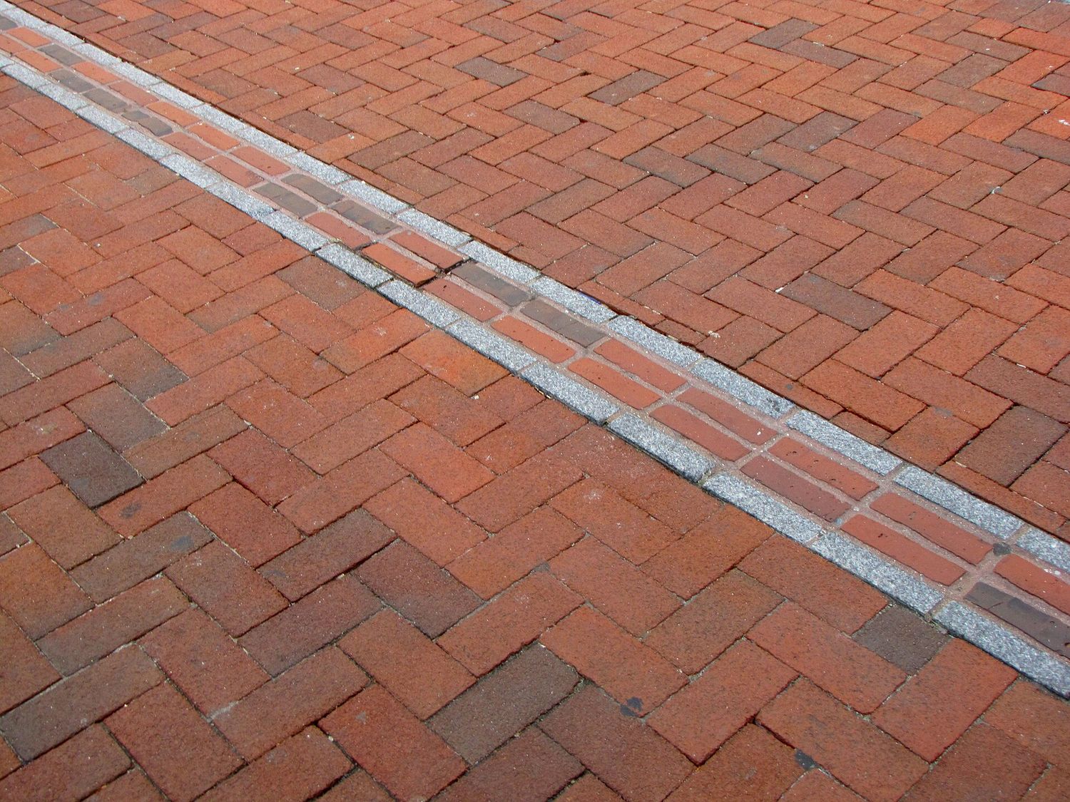
The line starts in the grass. Not with a sign or an arch or a ticket booth, but with a double row of red brick set into the path near the Boston Common Visitor Information Center, running off toward Tremont Street like something spilled. Follow it for two and a half miles and it will take you past the church where the lanterns hung, the graveyard where Paul Revere is buried, the balcony where the Declaration of Independence was read to a crowd that then tore the royal lion off the roof, and a warship still crewed by the United States Navy. The Freedom Trail is free, it is always open, and it is the single most efficient piece of city planning any American tourist board has ever come up with.
This guide walks all sixteen official stops in order, north from Boston Common to the Bunker Hill Monument in Charlestown, with what each one costs, how long it takes, whether the paid ones are worth the money, and what to do when you reach the end and find yourself across the river from your hotel. Every price here was checked in September 2026 — confirm before you book, because the historic sites adjust their admission more often than you would think.
What the Freedom Trail Actually Is
It was a newspaperman’s idea. In 1951 a Boston Herald Traveler journalist named William Schofield pointed out that the city’s historic sites were scattered across downtown with no logic connecting them, and that a visitor could walk within thirty feet of the Old State House without knowing it was there. He proposed a marked route. The city painted a line, later replaced most of it with brick, and by the end of the decade the thing had become one of the most copied urban tourism ideas in the world.
Practically, this means three things. First, it is a walking route, not an attraction — nobody sells tickets to the trail itself, and there is no gate. Second, the sixteen sites on it are run by at least half a dozen different organizations: the National Park Service, Revolutionary Spaces, the Paul Revere Memorial Association, the Old North Foundation, the City of Boston, the Commonwealth of Massachusetts, and the Navy. Their opening hours do not line up neatly, and their tickets are mostly separate. Third, and most usefully, eleven of the sixteen cost nothing at all.
The route is 2.5 miles one way. It is not a loop, which catches people out. If you walk it end to end and then walk back, you have done five miles, and the return leg is the same pavement you have already seen. Almost nobody should do this — see the section on getting back below.
Planning the Walk: Direction, Time and Money
Which direction to walk
Walk it south to north — Boston Common to Bunker Hill. Three reasons. The first eleven stops are packed into about a mile of downtown, so you get the dense, sit-down-and-read-a-plaque part while your feet are fresh. The two longest walks on the route come at the end, when you are warmed up. And Charlestown is a much better place to finish than to start: you can climb the monument, get a drink in a Navy Yard bar, and take a boat back across the harbor with the skyline in front of you.
The reverse direction has one argument in its favor, which is that Charlestown is quiet in the morning and the North End is horrible at midday in summer. If you are walking in July and you hate crowds, starting at Bunker Hill at 8am is a legitimate strategy. Otherwise, go the standard way.
How long it really takes
Walking the 2.5 miles without stopping takes about an hour. Nobody does that. Realistically:
- Two hours — you walk it briskly, read the outdoor plaques, go inside nothing. This is a real and respectable way to do the trail if you are short on time. You will still see the Old State House, the Old North Church steeple, the Granary, Faneuil Hall and the monument.
- Half a day, four to five hours — the sweet spot. Pay for two or three interiors, spend twenty minutes in the Granary, get lunch in the North End, climb the monument.
- A full day, seven hours plus — every paid interior, the USS Constitution Museum, the Bunker Hill Museum, a proper North End meal. This is a lot of history in one sitting, and by the Charlestown Bridge most people are running on fumes.
- Two half-days — split at Faneuil Hall or the Paul Revere House. Downtown one morning, North End and Charlestown the next. If you have the time, this is the best version, and it is the one locals recommend to visiting family.
What it costs
Eleven stops are free. The five that charge are the Massachusetts State House (free to enter, but by guided tour if you want the interior properly), the Paul Revere House, Old North Church, Old South Meeting House and the Old State House. Here is what you are actually deciding between, checked September 2026:
| Site | Adult | Child | Worth it? |
|---|---|---|---|
| Paul Revere House | $6 | $1 (5–17) | Yes. Cheapest real thing on the trail and the only c.1680 house you will stand in. |
| Old North Church | $10 | $5 (youth) | Yes. The $10 Discovery Pass now includes the crypt; add the 25-minute bell chamber tour for $15 if you can manage steep stairs. |
| Old State House + Old South Meeting House | $18 combined | $10 (6–17) | Yes if you like museums; the two are one Revolutionary Spaces ticket. |
| Boston 250 Pass | $33 | — | Yes if Old North and the Old State House are among four or five historic interiors; it saves about $6 if you use all five. Covers the Revere House, Old State House, Old North, Old South and King’s Chapel. |
| Walk Into History guided tour | $17 | $8 (6–12) | Depends — see below. |
| Boston CityPASS | $84 | $72 (3–11) | Not for this. It includes nothing on the Freedom Trail. |
That last row is the one worth underlining, because people buy the wrong pass constantly. Boston CityPASS is excellent value for the Aquarium, the Museum of Science and View Boston — it saves roughly $53 if you use four of its seven options — but it does not get you into a single Freedom Trail site. If your Boston trip is a history trip, the $33 Boston 250 Pass is the pass you want. Bought separately at September 2026 prices its five sites cost $39, so it saves about $6, and it pays for itself on the fourth site as long as Old North and the Old State House ticket are among them.
Add it up honestly: a family of four, two adults and two children aged 6 to 12, doing the three main paid interiors separately spends about $100 (checked September 2026). Doing the whole trail with no interiors at all costs nothing but a sandwich. Both are perfectly good days out.
Guided or on your own
The Freedom Trail Foundation’s Walk Into History tour costs $17 for adults, $8 for children aged 6 to 12, and $15 for seniors and students. It runs ninety minutes, departs Boston Common roughly hourly from 10am to 2pm, and is led by a guide in eighteenth-century costume who stays in character. It covers eleven of the sixteen sites and finishes downtown — it does not go to Charlestown, and admission to the interiors is not included.
Whether to take it comes down to temperament. The guides are genuinely good — most are working actors, and the better ones can hold forty people on a windy corner of School Street for ten minutes on the subject of a sidewalk mosaic. If you like being told stories, take it. If the costume and the “prithee, good sir” register makes you want to walk into traffic, do not; the trail is thoroughly signposted, the National Park Service runs free ranger-led programs from Faneuil Hall in season, and this page has the stops in order.
One thing a guided tour does solve: the middle of the trail, between the Old Corner Bookstore and Faneuil Hall, is where self-guided walkers lose the thread. Downtown Crossing is a working commercial district, the brick line disappears under construction hoardings, and three of the stops in a row are plaques rather than buildings. Know that it happens and it stops being annoying.
The 16 Stops, in Order
1. Boston Common
Public land since 1634 and the oldest public park in the United States, which it has been by being almost everything else first: a cow pasture, a militia drill field, a British Army camp during the occupation, a gallows site, and a place where Puritan Boston hanged Quakers. The Common is fifty acres of the messiest, most-used green space in the city, and unlike the manicured Public Garden across Charles Street it has never been precious about itself.
The trail starts near the Visitor Information Center at 139 Tremont Street, which has restrooms, maps and a desk with people who will answer questions. Use them — it is the last easy restroom for a while. Park Street station is directly underneath, served by the Red and Green Lines, and is the single most convenient starting point in the city.
Give it fifteen minutes. Walk up toward the State House past the Robert Gould Shaw and 54th Massachusetts Memorial, a bronze relief by Augustus Saint-Gaudens facing the State House across Beacon Street. It commemorates the Union Army’s first Black regiment recruited in the north, and it is the finest piece of public sculpture in Boston. Most Freedom Trail walkers glance at it for four seconds on their way up the hill. It deserves considerably more.
2. Massachusetts State House
Charles Bulfinch’s 1798 building, and the reason so many American statehouses look the way they do. The dome was wooden shingle at first, then sheathed in copper by Paul Revere’s company in 1802, then gilded in 1874. It was painted gray during the Second World War so it would not glint for bombers. Inside, in the House chamber, hangs the Sacred Cod: a five-foot carved wooden fish that has represented the fishing industry’s place in the Commonwealth since the eighteenth century, and which Harvard students once stole as a prank, causing the House to suspend business.
Free guided tours run weekdays, roughly 10am to 3:30pm, last about forty minutes and start in Doric Hall. The building itself is open weekdays 8:45am to 5pm and closed weekends and holidays, which is the practical catch — if you are walking the trail on a Saturday you are looking at the outside only. Groups of ten or more should call the tours office well in advance; check current arrangements with the Secretary of the Commonwealth’s tours division before you plan around it.
3. Park Street Church
The 217-foot white steeple at the corner of Park and Tremont, built in 1809, and for a while the tallest structure in the country. The corner it stands on was called Brimstone Corner, probably because gunpowder was stored in the crypt during the War of 1812, and possibly because of what the pulpit was like.
Two things happened here worth knowing. William Lloyd Garrison gave his first public antislavery address from this pulpit in 1829, three years before founding the New England Anti-Slavery Society in the basement of the African Meeting House. And “America” — the one that goes “My country, ’tis of thee” — was first sung publicly here on 4 July 1831, by the children’s choir.
The interior is open to visitors on a limited seasonal schedule and it is an active congregation, so it is not always available. Five minutes from the outside is a fair allocation.
4. Granary Burying Ground
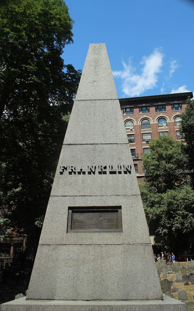
If you only stop properly at one place on the first half of the trail, make it this one. Founded in 1660 on land that had been the town granary, it holds Samuel Adams, John Hancock, Robert Treat Paine, Paul Revere, the five men killed in the Boston Massacre — including Crispus Attucks — and, by long tradition, Mary Goose, who may or may not be Mother Goose.
There are roughly 2,300 markers and something in the region of five thousand people. The two numbers do not match because in the 1840s the stones were pulled up and rearranged into tidy rows so the grass could be mown more easily. This means, quite literally, that most of the headstones are not standing over the person named on them. It is the single best fact on the Freedom Trail and no plaque tells you it.
The Franklin obelisk in the middle marks Josiah and Abiah Franklin, Benjamin’s parents. Benjamin left Boston at seventeen and is buried in Philadelphia. Roughly one visitor in three appears to believe otherwise.
Free, open daily, generally 9am to 5pm and shorter in winter. Twenty minutes. Look at the carvings on the older slate stones — the winged skulls of the 1600s giving way to winged cherubs, then to urns and willows, as Puritan Boston slowly stopped being frightened of dying.
5. King’s Chapel and King’s Chapel Burying Ground
Two sites in one, and the burying ground is the older by more than half a century. It opened in 1630 as Boston’s first cemetery, and holds John Winthrop, the colony’s first governor, and Mary Chilton, who came over on the Mayflower and is said to have been the first European woman to step ashore at Plymouth.
The chapel itself is a story about spite. The first Anglican congregation in Puritan New England was established in 1686 by royal governor Edmund Andros, who could not persuade any Congregationalist to sell him land, so he simply took a corner of the town burying ground and built on it. The current dark granite building, by Peter Harrison, went up around the old wooden one in 1749; the congregation ran out of money before the steeple, which is why it looks unfinished from the street. It has been Unitarian since 1785. The bell inside was recast by Paul Revere and is the largest he ever made.
General admission to the chapel is $5 (checked September 2026), with a 45-minute Bells and Bones tour of the crypt and galleries at $15, and it is included on the Boston 250 Pass. The burying ground is free. Fifteen minutes for both, or longer if you catch one of the lunchtime music recitals.
6. Boston Latin School Site and the Benjamin Franklin Statue
A mosaic in the sidewalk on School Street, in front of Old City Hall, marking where Boston Latin stood from 1635. It is the oldest public school in America and it is still going, out toward Fenway, still selective, still turning out people who will tell you about it. Four signers of the Declaration went there. So did Franklin, who dropped out.
The 1856 Franklin statue beside it was the first portrait statue erected in Boston. Old City Hall behind it, French Second Empire and gloriously overdone, was the city’s seat of government from 1865 to 1969 and now contains offices and a steakhouse. Five minutes, and it is genuinely just a mosaic and a statue.
7. Old Corner Bookstore
Built in 1718 as an apothecary’s shop and house, this is the oldest commercial building in downtown Boston. From 1832 it housed Ticknor and Fields, the publisher that printed Hawthorne, Emerson, Longfellow, Harriet Beecher Stowe and the Atlantic Monthly, and for about thirty years the ground floor was where American literature happened. Dickens came here.
Today it is a Chipotle.
That is not a complaint, exactly — the building was slated for demolition as a parking lot in 1960 and was saved by a preservation group that has kept it in commercial use ever since, which is why it is standing at all. But be clear about what you are stopping for: a plaque, a nice bit of brick, and a burrito. Three minutes unless you are hungry.
8. Old South Meeting House
On 16 December 1773 about five thousand people — a substantial fraction of the entire population of Boston — crammed into and around this building to argue about tea. When the meeting broke up, some of them went down to Griffin’s Wharf and threw 342 chests of it into the harbor.
The building dates from 1729 and was the largest meeting space in colonial Boston, which is why the political meetings happened here rather than in Faneuil Hall. The British Army’s revenge was petty and precise: during the siege they stripped out the pews and the pulpit and used the interior as a riding school for the cavalry, with a bar in the gallery.
It is run today by Revolutionary Spaces, open daily 10am to 5pm, and admission is $18 for adults on a combined ticket with the Old State House, $16 for seniors and $10 for children 6 to 17. Thirty to forty minutes. The exhibition is better than it needs to be, and the acoustics tell you something a photograph cannot: this is a room built for a voice to carry to five hundred angry people.
9. Old State House
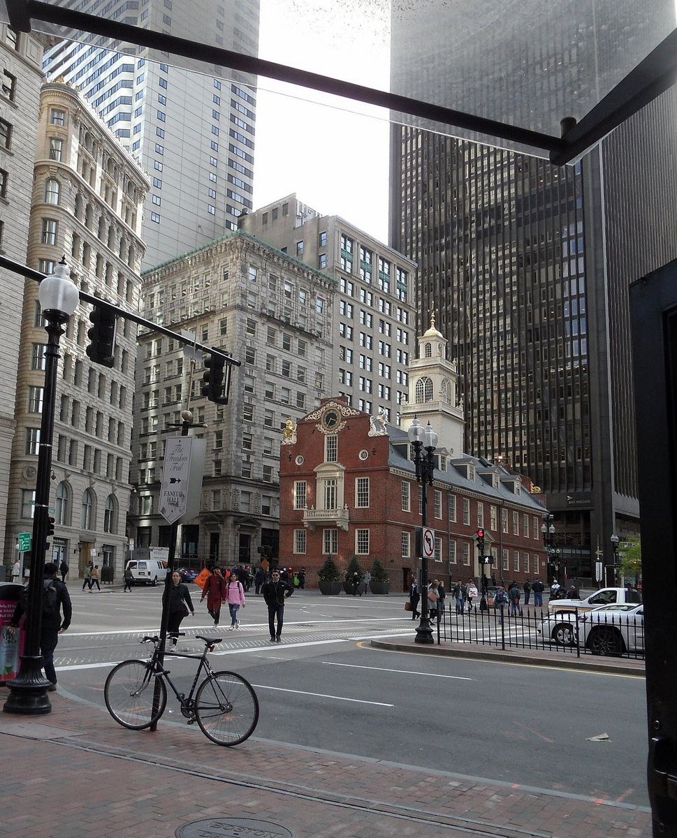
Built in 1713, the oldest surviving public building in Boston, and now completely surrounded by the financial district in a way that is worth standing still for thirty seconds to appreciate. It was the seat of colonial government: the Royal Governor’s council chamber upstairs, the merchants’ exchange below, and the lion and the unicorn on the roof announcing whose building it was.
On 18 July 1776 the Declaration of Independence was read to Boston from the balcony on the State Street end. The crowd immediately pulled the lion and unicorn down and burned them in the street. The ones up there now are replicas, and the Declaration is still read from that balcony every 4 July.
Inside is a Revolutionary Spaces museum on the same combined ticket as Old South. Open daily 10am to 5pm. The strange, excellent detail: State Street T station is directly beneath the building, and one of the entrances runs through the Old State House itself. You can walk down a staircase inside a 1713 landmark and come out on a Blue Line platform.
10. Boston Massacre Site
A ring of cobblestones set in a traffic island beneath the Old State House balcony. On the evening of 5 March 1770 a crowd surrounded a British sentry, a squad came to his aid, someone shouted, the soldiers fired, and five men died. Crispus Attucks, a dockworker of African and Wampanoag descent, was the first.
Samuel Adams and Paul Revere turned the killings into the most effective propaganda of the pre-war years. And then John Adams — Samuel’s cousin, and a man who thought the mob was as dangerous as the Crown — defended the soldiers in court, got six of eight acquitted and the other two branded on the thumb rather than hanged. He later called it one of the best things he ever did for his country.
The marker itself takes ninety seconds and involves standing on a busy island while traffic goes past. Read the story first and it lands. Walk up to it cold and it is a circle of stones.
11. Faneuil Hall
Peter Faneuil gave the town a market building with a meeting hall on top in 1743. He was one of the richest merchants in Boston and a good deal of that money came from trading in enslaved people, a fact the site now addresses directly rather than skating over, and there have been serious campaigns to rename the building.
The Great Hall upstairs is where the town meetings that led toward revolution were held, and it is free, and it is beautiful, and a startling number of visitors never go up. National Park Service rangers give short talks in the hall through the day — check the schedule at the visitor center on the ground floor or at nps.gov/bost. Twenty minutes, free, and among the best value on the trail. Look up at the grasshopper weathervane on the way in: Shem Drowne made it in 1742, and during the Revolution it was reportedly used as a test of identity, on the grounds that no British spy would know what was on top of Faneuil Hall.
Now the honest part. Quincy Market, the long granite hall behind it, is not the same building and is not on the trail. It went up in 1826, it is architecturally handsome, and inside it is a shopping-mall food court with a Cheers gift shop. If you have come to Boston to eat, walk another eight minutes to the North End instead. If you have three children who are melting down, Quincy Market has a hundred food stalls under one roof and there is no shame in that at all.
12. Paul Revere House
Cross the Greenway into the North End and the trail changes character completely — narrow streets, brick, laundry, the smell of garlic and espresso, and about four inches of sidewalk.
The house on North Square was built around 1680 and is the oldest surviving house in downtown Boston. Revere owned it from 1770 to 1800 and it was from here that he left on the night of 18 April 1775. It survived because it spent the nineteenth century as a tenement and cigar factory in an immigrant neighborhood nobody thought was worth redeveloping, and it was restored in 1908 in one of the earliest historic-house preservation projects in the country.
Admission is $6 for adults, $5.50 for students, $1 for children 5 to 17. Allow forty minutes. It is small, the floors creak, and the rooms are cramped in a way that tells you more about eighteenth-century domestic life than any reconstruction could. It is the best six dollars on the Freedom Trail.
13. Old North Church
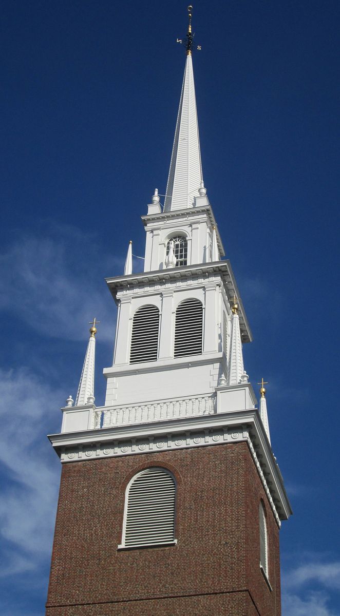
Christ Church in the City of Boston, 1723, the oldest surviving church building in the city and the place the whole revolutionary story hangs on. On the night of 18 April 1775, sexton Robert Newman and vestryman John Pulling climbed the steeple and hung two lanterns for perhaps a minute — long enough for watchers in Charlestown to see them, short enough not to be caught. Two lanterns meant the British were crossing the Charles by water. The signal was not for Revere; it was the backup in case Revere did not get out of Boston.
The Discovery Pass is $10 for adults and $5 for young people, free for 5 and under (checked September 2026), and covers the church and the crypt with an audio guide. The eight bells in the tower were cast in England in 1744 and are the oldest change-ringing peal in North America; Paul Revere rang them as a teenager. The only add-on now is a 25-minute guided tour of the bell chamber, up two sets of steep stairs, which brings the ticket to $15 for adults and $10 for young people. Do not skip the crypt, which is included — there are roughly a thousand people interred beneath the floor you have been standing on.
Thirty to forty-five minutes for the church and crypt, about an hour with the bell chamber tour. That tour takes up to twenty people at a time, so in summer buy it early in the day. Visitor hours are Monday to Saturday 10am to 5pm and Sunday 12:30pm to 5pm.
14. Copp’s Hill Burying Ground
Boston’s second-oldest cemetery, opened in 1659, up the hill from Old North and free. Three generations of Mathers are in the family tomb — Increase, Cotton and Samuel — along with a great many of the North End’s colonial artisans, and around a thousand free and enslaved Black Bostonians buried at the Copp’s Hill end of the ground, most of them unmarked.
The British placed artillery here in June 1775 and shelled Charlestown from this hilltop while the Battle of Bunker Hill was going on across the water, burning the town to the ground. Look at Daniel Malcolm’s slate stone, which describes him as “a true son of Liberty”: the pockmarks in it are said to be from British soldiers using it for target practice.
Fifteen minutes, and stand at the northwest corner for the view over the water to Charlestown, where you are going next. It is the best free view on the trail.
15. USS Constitution
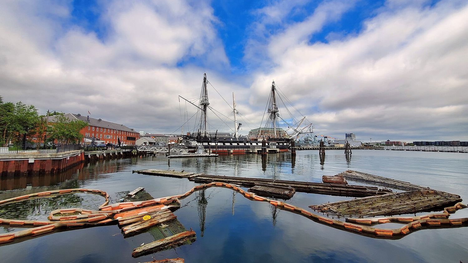
Over the Charlestown Bridge, which is windy and loud and takes about ten minutes, and into the Navy Yard. The ship was launched in 1797, one of six frigates authorized by the new republic, and she is the oldest commissioned warship afloat anywhere in the world. In the War of 1812 she took HMS Guerriere in well under an hour and earned the name Old Ironsides when British shot was seen bouncing off her live-oak hull.
Boarding is free. Adults 18 and over need photo ID and everyone goes through a security screening, because this is an active US Navy installation. The sailors giving you the tour are on a real assignment. Hours vary by season and the ship occasionally closes for maintenance or ceremonial duty, so check the National Park Service page the morning you go.
The USS Constitution Museum is a separate building a few steps away, also free, with a suggested donation of $10 to $15 for adults and $5 to $10 for children. It is aimed squarely at families and it is very good at it — you can haul on a rope, try a hammock and vote on whether to fight the Guerriere. Allow ninety minutes for ship and museum together.
16. Bunker Hill Monument
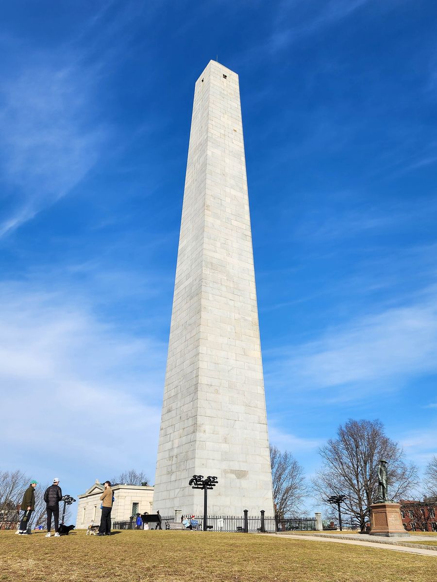
A 221-foot granite obelisk on top of a steep residential hill, ten minutes uphill from the Navy Yard through some of the prettiest streets in Boston. It commemorates the battle of 17 June 1775, which was fought on Breed’s Hill, where the monument stands, and not on Bunker Hill, which is the next hill over. The colonial militia lost the ground and inflicted well over a thousand casualties doing it, which changed London’s assessment of the war overnight.
Climbing it is free and there are 294 steps and no elevator. The stairwell is narrow, unventilated and two-way, and in August it is genuinely unpleasant. The reward at the top is four small windows and a view across the harbor and down onto downtown. Do it if you are fit and it is not ninety degrees. Skip it without guilt if either of those is not true — the monument is more impressive from the grass at its base anyway, and the free Bunker Hill Museum across the street has a good diorama and, importantly, restrooms.
Access to the shaft can close for weather, staffing or maintenance, so check on the day.
Getting Back from Charlestown
This is the part of the trail nobody plans and everybody needs. You are 2.5 miles from where you started, your legs are done, and walking back is a bad idea.
- The ferry. Best option by a distance. MBTA boats run from Pier 4 at the Charlestown Navy Yard to Long Wharf downtown in about ten minutes, and the approach to the skyline from the water is the nicest thing that will happen to you all day. Sailings are less frequent on weekends and the schedule changes seasonally — check times and the current fare at mbta.com before you leave the monument, because missing one costs you half an hour on a cold pier.
- The Orange Line. Community College station is about a ten-minute walk downhill from the monument. $2.40, and it gets you to Downtown Crossing or Back Bay quickly.
- The 93 bus runs from Charlestown back through Haymarket for $1.70, which is the cheapest way and fine if the traffic is not bad.
- Walking back over the bridge to the North End is twenty minutes and only makes sense if you skipped dinner and are heading for it.
Since the MBTA started piloting unlimited transfers within a two-hour window in September 2026, a ferry-then-subway combination on the same card or phone should not cost you two full fares — you pay the highest-priced service you used. Tap the same card or device all day.
Eating Along the Way
The trail runs directly through the North End, which means you are walking past better food than most cities can manage, and the correct move is to plan lunch or dinner around stops 12 to 14 rather than eating downtown.
- Galleria Umberto, Hanover Street — lunch only, cash only, opens late morning and closes when the Sicilian slices run out, often by early afternoon. A slice and an arancino for a few dollars. Join the line; it moves.
- Regina Pizzeria on Thacher Street — the original 1926 location, not the mall branches. Thin, blistered, no reservations, and worth the detour off Hanover.
- Neptune Oyster, Salem Street — the best seafood on the trail, tiny, no reservations, and the wait can run past ninety minutes at peak. Put your name down and go climb Copp’s Hill.
- Cannoli — Mike’s Pastry has the boxes and the line and the string; Modern Pastry, a few doors along, fills the shell to order so it is not soggy. Modern is better. This is a real argument in Boston and you are allowed to have a side.
- Downtown, between stops 5 and 11, the options thin out to chains and office lunch spots. The Union Oyster House near Faneuil Hall has been serving since 1826 and has the history, the toothpicks and the Kennedy booth; the food is fine rather than good, and you are paying for the room.
Charlestown at the end has a handful of decent pubs in the Navy Yard and around City Square. Fill your water bottle before Bunker Hill, not after.
What the Red Line Leaves Out
The Freedom Trail tells one story extremely well: white, male, Revolutionary Boston, roughly 1770 to 1783. That story is real and it matters. It is also about a fifth of what happened in these streets, and if you have a second day, the additions are where Boston gets interesting.
The Black Heritage Trail runs 1.6 miles across the north slope of Beacon Hill and is, mile for mile, the more remarkable route. It links the homes of the free Black community that made Boston a center of American abolitionism, and ends at the African Meeting House of 1806 — the oldest surviving Black church building in the country, where Garrison founded the New England Anti-Slavery Society, and where the 54th Massachusetts was recruited. National Park Service rangers lead it free in season. It starts at the Shaw Memorial you walked past at stop 1.
The Boston Tea Party Ships and Museum on the Congress Street Bridge is not a Freedom Trail site, but it is where the tea went in, more or less, and it costs $35 to $39 for adults and $26 for children 3 to 12 on timed entry. It is a full-on immersive production with actors and a replica brig, and it is either exactly your thing or exactly not.
The Harborwalk, 43 miles of continuous public waterfront, crosses the trail at the Greenway and is free, uncrowded and lovely.
And a great deal of ordinary Boston — the neighborhoods, the museums, the Emerald Necklace — sits within a mile of the red line without ever touching it. Our guide to things to do in Boston covers what to do with the rest of the trip once the history is done.
Practical Notes
Getting to the start
Park Street on the Red and Green Lines puts you at the Visitor Information Center in ninety seconds. Boylston and Government Center also work. A single subway ride is $2.40 on any payment method, a day pass is $11 and a seven-day pass is $22.50. Do not drive — downtown Boston parking runs $40 or more for the day, and the streets around Faneuil Hall were laid out for handcarts.
Accessibility
The trail is broadly walkable with a wheelchair or a stroller, but not uniformly. Downtown is flat and paved. Beacon Hill up to the State House is a real hill. The North End has narrow sidewalks, cobbles on some streets, and doorways into buildings from the 1680s that were not built with ramps in mind — the Paul Revere House in particular has significant limitations upstairs. Copp’s Hill has uneven ground. The Bunker Hill Monument shaft is stairs only, all 294 of them. Check individual sites in advance; most publish detailed access information, and several can make alternative arrangements if you call ahead.
Weather and what to wear
Shoes matter more than anything else here. Two and a half miles is nothing; two and a half miles of brick, granite setts and colonial cobble in bad shoes will end your day early. Boston rain arrives sideways off the water and an umbrella is often useless — bring a hood. In July and August the downtown blocks hold heat and the North End has almost no shade, so start at 9am. From December to March the sites keep shorter hours, some close entirely on weekdays, and the wind on the Charlestown Bridge is memorable. Spring and fall are the best walking conditions by a wide margin, with foliage in the Common and along the Greenway peaking mid-to-late October.
Restrooms
An underrated planning issue on a three-hour outdoor walk. Reliable stops: the Boston Common Visitor Information Center at the start, Faneuil Hall’s ground-floor visitor center in the middle, the USS Constitution Museum and the Bunker Hill Museum at the end. Between the Granary and Faneuil Hall you are relying on cafés.
Mistakes People Make
- Buying CityPASS for a history trip. It is a good pass. It includes nothing on this trail.
- Walking it as an out-and-back. Take the ferry or the Orange Line home.
- Booking a Duck Tour to “see the sights” first. At $57 for adults and $42 for children, plus a 5% Convention Center fee and a $2 booking fee on top, the Duck Tour costs a family of four well over $200 to be driven around a city you can cross on foot in forty minutes. The splash into the Charles is genuinely fun and children love it, so if that is what you are buying, buy it happily — but it is not an orientation tour worth two hundred dollars in a city this small.
- Doing all sixteen stops with young children in one day. Stop at Faneuil Hall, get lunch, go to the Aquarium. The trail will still be there tomorrow.
- Eating at Quincy Market by default because it is right there and the North End is eight minutes further. It is eight minutes.
- Arriving at the State House on a Sunday expecting to go in. Weekdays only.
- Assuming everything is open year-round. Winter hours are shorter across the board, and the Swan Boats in the Public Garden — which people routinely tack onto a trail walk — only run from mid-April to early September.
Frequently Asked Questions
How long does the Freedom Trail take?
About an hour of pure walking for the 2.5 miles. Two hours if you read the outdoor markers and go inside nothing, four to five hours for the standard version with two or three paid interiors and lunch, and a full day if you want every museum. Splitting it over two half-days at Faneuil Hall is the most comfortable way to do it.
Is the Freedom Trail free?
The trail itself costs nothing and is always open — there is no ticket, no gate and no fee to follow the red line. Eleven of the sixteen sites are also free, including Boston Common, the Granary Burying Ground, Faneuil Hall, Copp’s Hill, USS Constitution and the Bunker Hill Monument. Five charge admission, ranging from $6 at the Paul Revere House to $18 for the combined Revolutionary Spaces ticket.
Which direction should I walk the Freedom Trail?
South to north, from Boston Common to the Bunker Hill Monument. The downtown stops are close together at the start when your feet are fresh, and finishing in Charlestown means you can take the ferry back across the harbor rather than retracing your steps.
Do I need a guided tour?
No. The route is marked in brick and paint the whole way and the sites are well signposted. The Freedom Trail Foundation’s costumed Walk Into History tour is $17 for adults and $8 for children 6 to 12, runs ninety minutes and covers eleven sites without going to Charlestown or including admissions. National Park Service rangers also run free programs from Faneuil Hall in season. Take a guide if you like being told stories; skip it if you would rather read at your own pace.
Is the Boston CityPASS worth it for the Freedom Trail?
No — CityPASS covers none of the Freedom Trail sites. At $84 for adults and $72 for children 3 to 11 it is good value for the Aquarium, Museum of Science, View Boston and the MFA, saving around $53 against gate prices. For the trail itself, the $33 Boston 250 Pass covering five historic sites is the one that pays back.
Can you do the Freedom Trail with kids?
Yes, with edits. Young children manage the downtown half well — the Granary is a hit, Faneuil Hall has space to run, and the Old State House museum is short. The stretch from the Paul Revere House to Bunker Hill is where the wheels come off. Either finish at Old North Church and get gelato on Hanover Street, or take the ferry straight to the Navy Yard on a second day and do Constitution and the monument as their own outing. The USS Constitution Museum is the most child-friendly stop on the entire route, and it is free.
Is Paul Revere buried on the Freedom Trail?
Yes — in the Granary Burying Ground, stop 4, alongside Samuel Adams, John Hancock and the victims of the Boston Massacre. Benjamin Franklin is not; the obelisk in the middle of the Granary marks his parents, and Franklin himself is buried in Philadelphia.
What is the best time of year to walk it?
Late April to early June, and September to late October. The walking weather is right, the sites are on full summer hours, and city foliage peaks mid-to-late October. July and August are hot, humid and crowded, especially in the North End. December to March is perfectly walkable if you dress for wind, but daylight is short and several sites cut their hours or close midweek.
Where does the Freedom Trail start and end?
It starts on Boston Common near the Visitor Information Center at 139 Tremont Street, directly above Park Street station on the Red and Green Lines, and ends at the Bunker Hill Monument in Charlestown. The two ends are 2.5 miles apart and the route does not loop.
The trail is a full day on its own, and it fits into a longer trip better than most people expect. If you are working out how to slot it into two, three or five days in the city, our Boston itinerary guide builds the routes around walking distances that actually cluster, flags the museum closing days that catch visitors out, and gives a realistic daily budget.
If the trail is the reason you are coming, it is worth basing yourself accordingly: downtown and the North End put you on the red line itself, and you can walk the quiet early stretch before the tour groups arrive. Our guide to where to stay in Boston compares those areas against Back Bay, Cambridge and the rest, with honest notes on stairs, noise and what a room really costs.
The trail passes through the North End at almost exactly lunchtime, which is either lucky or a trap depending on which end of Hanover Street you stop at. Our guide to the best restaurants in Boston explains where the line falls between the tourist blocks and the ones locals use, and what to order once you are past it.
The awkward part of the trail is the journey home from Charlestown, and it is worth planning before your legs give out. Our guide to getting around Boston sets out the ferry, the Orange Line and the bus with current fares, alongside everything else you need to move around the city without wasting money.
The trail tells the Boston half of the story; the shooting started fifteen miles away. Our guide to day trips from Boston covers Concord and Minute Man National Historical Park, where you can walk the road the British column retreated down, alongside Salem, Cape Ann and everywhere else within an hour of North Station.
If you would rather have a guide for part of the walk, the costumed Walk Into History tour is the best-value option, and it is only one of several. Our comparison of Boston sightseeing tours weighs it against Boston by Foot, the free National Park Service ranger talks at Faneuil Hall and the trolleys that cover the same ground by road.
The trail’s first stop deserves more than the two minutes most walkers give it. Our guide to Boston Common covers the Shaw Memorial, the Central Burying Ground, the Frog Pond and the history of the field itself — hangings, a British army camp and four centuries of rallies — with a short loop you can do before setting off up the hill.
Stop 11 deserves more time than most walkers give it. Our guide to Faneuil Hall Marketplace covers the free fifteen-minute ranger talks in the Great Hall, held Wednesday to Sunday on the half hour, the little-known artillery museum on the top floor, and where to eat nearby instead of the Quincy Market food court.
If you want the route laid out leg by leg before you set off, our Freedom Trail map guide breaks the walk into its three sections, with the walking time between every stop, the T station nearest each one, where to pick up a free printed map, and the five places where people most often lose the red line.
If you are trying to fit the walk into a tight trip, our guide to how long the Freedom Trail takes breaks the 2.5 miles down by section and by leg, sets out how long each stop really needs, and gives six schedules, from a two-hour outside-only sprint to a relaxed two-day version.