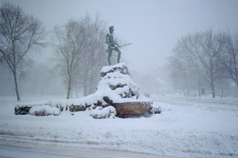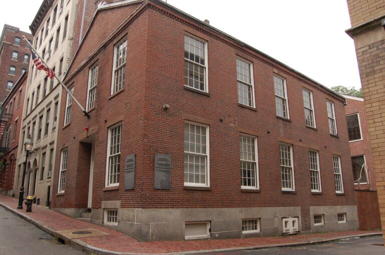
The Freedom Trail comes with its own map built into the sidewalk: a line of red brick, two bricks wide, that leaves Boston Common and does not stop until it reaches the top of a hill in Charlestown. Most of the time you could follow it with your eyes shut. Then it dives under a construction hoarding in Downtown Crossing, or fades into a painted stripe across a busy crossing, or splits around a hot-dog cart, and you find yourself standing on a corner turning your phone around. A good Freedom Trail map is for those moments, and for deciding, before you start, which parts of 2.5 miles you actually want to walk.
This guide lays out the whole route in three sections, with the 16 official stops in order, turn-by-turn directions between them, rough walking times, the nearest T stations for joining or leaving, restrooms, the spots where people lose the line, and where to pick up a free printed map. It finishes with shorter routes and a few worthwhile detours just off the red line. Prices and hours were checked in September 2026; confirm before you go.
The Freedom Trail map at a glance
| # | Stop | Section | Walk from previous stop | Cost | Nearest T |
|---|---|---|---|---|---|
| 1 | Boston Common | Downtown | Start | Free | Park Street (Red, Green) |
| 2 | Massachusetts State House | Downtown | 3 min | Free tours, weekdays | Park Street |
| 3 | Park Street Church | Downtown | 3 min | Free | Park Street |
| 4 | Granary Burying Ground | Downtown | 1 min | Free | Park Street |
| 5 | King’s Chapel and Burying Ground | Downtown | 3 min | Included in Boston 250 Pass | Park Street, Government Center |
| 6 | Boston Latin School site and Franklin statue | Downtown | 1 min | Free | State, Downtown Crossing |
| 7 | Old Corner Bookstore | Downtown | 2 min | Free (outside) | Downtown Crossing |
| 8 | Old South Meeting House | Downtown | 1 min | $18 with Old State House | Downtown Crossing, State |
| 9 | Old State House | Downtown | 3 min | $18 with Old South | State (Orange, Blue) |
| 10 | Boston Massacre Site | Downtown | 1 min | Free | State |
| 11 | Faneuil Hall | Downtown | 4 min | Free | Government Center, Haymarket |
| 12 | Paul Revere House | North End | 8–10 min | $6 | Haymarket |
| 13 | Old North Church | North End | 5 min | $10 | Haymarket, North Station |
| 14 | Copp’s Hill Burying Ground | North End | 3 min | Free | North Station |
| 15 | USS Constitution | Charlestown | 15–20 min | Free (photo ID 18+) | Ferry to Navy Yard; North Station |
| 16 | Bunker Hill Monument | Charlestown | 10–15 min, uphill | Free | Community College (Orange) |
Walking times are at an easy pace with no stops inside. The first eleven stops are packed into roughly a mile of downtown; the North End adds about half a mile; and the stretch from Copp’s Hill across the Charlestown Bridge to the Navy Yard and up to the monument is the last mile, with the two longest walks on the route. See our main Freedom Trail guide for what to see at each stop.
How to read the line

For most of the route the trail is marked by a double row of red bricks set into the sidewalk. On concrete and asphalt, and across many crossings, it switches to a painted red line, which wears thin and is easy to lose in heavy foot traffic. At some stops you will also see round markers set into the line naming the trail. The line runs in both directions, so you can follow it south to north or the other way, and it does not branch: if you find two red lines, one of them is a shop’s idea of decoration.
The numbers on official maps run from 1 at Boston Common to 16 at Bunker Hill. Almost everyone walks it in that direction, and there are good reasons to: the dense downtown stops come first, while your feet are fresh, and you finish in Charlestown with a harbor ferry back. The one argument for the reverse is avoiding the North End at midday in high summer; our main guide covers the choice.
Where the map came from
The Freedom Trail is younger than it looks. The sites along it are colonial and Revolutionary, but the trail joining them was invented in 1951, when a Boston newspaper columnist, William Schofield, suggested that the city link its scattered landmarks with a single walking route so that visitors would stop getting lost looking for them. Mayor John Hynes backed the idea and the historic sites signed on. The line on the sidewalk came afterwards, as a way of making the route impossible to miss.
That origin explains a lot about the map. The route was drawn to connect buildings that already existed rather than to tell a neat chronological story, which is why it zigzags from a 1798 State House to a 1660 burying ground to a 1729 meeting house, and why it detours into North Square to reach a house that happens to have survived. The sixteen official sites are looked after by different owners, from the National Park Service to churches, private nonprofits and the City of Boston, which is why their hours and prices vary so much. The Freedom Trail Foundation, a nonprofit, now looks after the trail as a whole.
Where to get a printed Freedom Trail map
You do not need to buy one. Free maps are easy to find, and they are all you need.
- Boston Common Visitor Information Center, 139 Tremont Street, beside Park Street station, right at stop 1. It hands out maps and brochures and is where the Freedom Trail Foundation’s guided walks depart. Listed hours are roughly 8:30am to 5pm on weekdays and 9am to 5pm on weekends.
- The National Park Service visitor center on the first floor of Faneuil Hall, stop 11. Rangers and volunteers hand out the Park Service’s Freedom Trail map and guide, along with junior ranger books for children. From October to Memorial Day it is open Wednesday to Sunday; in summer, Tuesday to Sunday.
- Online. The Park Service publishes its Freedom Trail and Charlestown Navy Yard maps on the Boston National Historical Park maps page, which you can download before you arrive. There is also an audio-described Freedom Trail brochure for visitors who are blind or have low vision.
- The Freedom Trail Foundation, the nonprofit that looks after the trail, lists all 16 sites on thefreedomtrail.org and sells a Freedom Trail tour app.
A phone map works fine too. Search for each stop by name, or drop a pin on the next one. Honestly, the combination of the red line, a free paper map and your phone covers everything; there is no need to pay for a map or an app unless you want the extra commentary.
Section 1: Downtown, stops 1 to 11
About a mile, with eleven stops. Allow 45 minutes just to walk it and read the outside plaques, or two to three hours with two interiors and a proper look at the Granary.
Boston Common to the State House (stops 1–2)
Start at the Visitor Information Center on Tremont Street. The line climbs diagonally across the Common toward the gold dome at the top, crossing Beacon Street to the Massachusetts State House. Opposite the State House, on the edge of the Common, is the Shaw Memorial to the 54th Massachusetts Regiment; the Black Heritage Trail begins here, if you want to come back for it. Free guided tours of the State House run on weekdays only, roughly 10am to 3:30pm; it is closed on weekends.
Down Park Street to the Granary and King’s Chapel (stops 3–5)
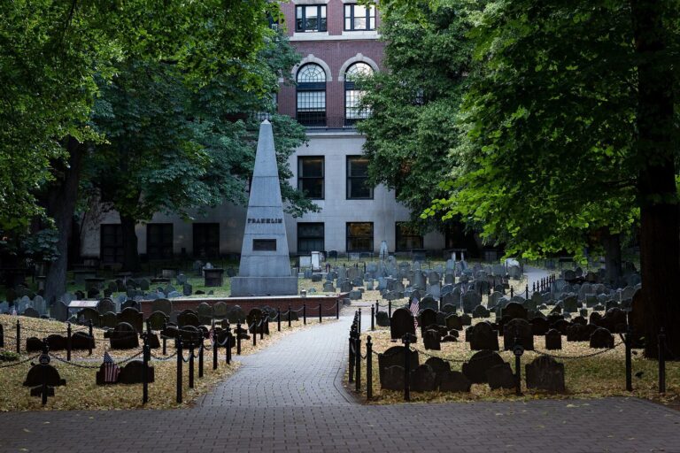
Follow the line back down Park Street, which runs along the edge of the Common, to Park Street Church on the corner of Tremont Street. The Granary Burying Ground is immediately next door on Tremont; go in, since the line only runs past the gates, and find Paul Revere, Samuel Adams, John Hancock and the Boston Massacre victims. Continue along Tremont to King’s Chapel, the granite church at the corner of School Street, with Boston’s oldest burying ground beside it.
School Street to the Old State House (stops 6–10)
Turn down School Street. Outside Old City Hall, a sidewalk mosaic marks the site of Boston Latin School, the oldest public school in America, and a statue of its most famous dropout, Benjamin Franklin, stands in the courtyard. At the bottom of School Street, on the corner of Washington Street, is the Old Corner Bookstore.
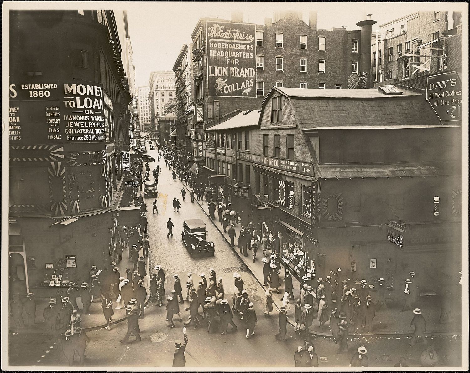
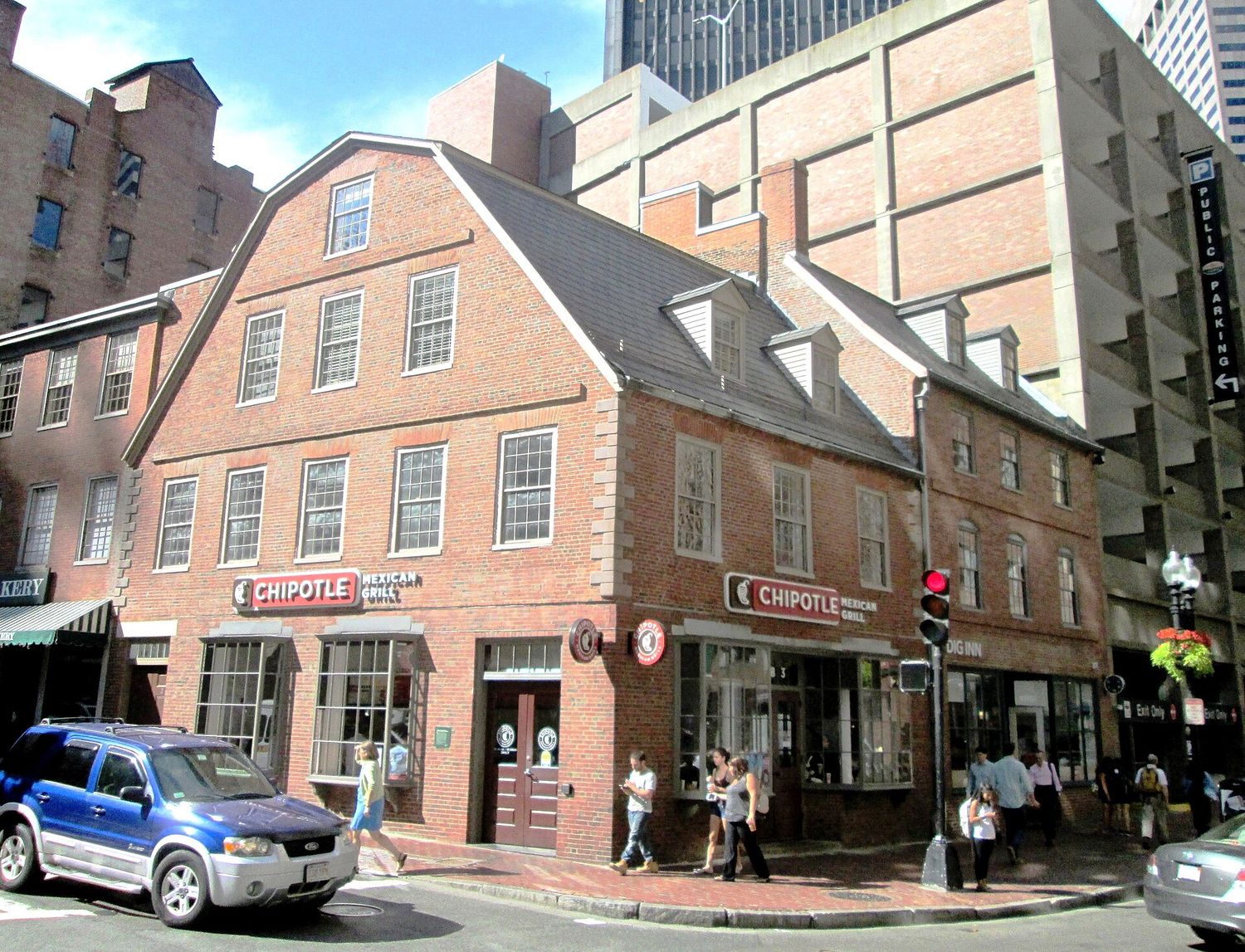
Built around 1718, it is one of the oldest commercial buildings in the city, and in the nineteenth century it housed Ticknor and Fields, the publishers of Hawthorne, Emerson, Longfellow and Thoreau. Today it is a stop you look at from the sidewalk rather than a museum you enter.
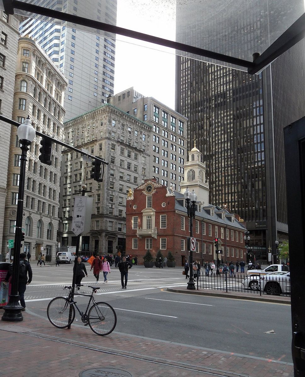
Turn right along Washington Street for a minute to Old South Meeting House, at the corner of Milk Street, then walk north up Washington to the Old State House, the brick building with the lion and unicorn on its gable, sitting in the middle of the traffic at State Street. One ticket, $18 for adults, $16 for seniors and $10 for ages 6 to 17, covers both Old South and the Old State House, and both are open daily from 10am to 5pm. On the far side of the Old State House, where State and Devonshire Streets meet, a ring of cobblestones set into the traffic island marks the Boston Massacre site.
To Faneuil Hall (stop 11)
From the Massacre site the line heads down toward Congress Street and Dock Square, where Faneuil Hall stands with its gilded grasshopper weathervane. The Great Hall upstairs is free, with 15-minute ranger talks Wednesday to Sunday from 10:30am to 3:30pm, and the NPS visitor center with free maps is on the first floor. Quincy Market is directly behind it. Our Faneuil Hall Marketplace guide separates what is worth your time there from what is not.
Section 2: The North End, stops 12 to 14
About half a mile, with three stops, and the best food on the trail. Allow an hour and a half with two interiors, more with lunch.
Faneuil Hall to the Paul Revere House (stop 12)
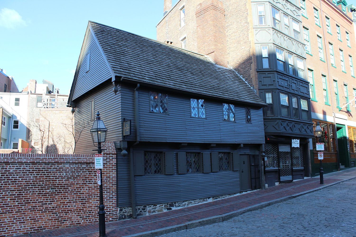
This is the first real walk on the trail. From Faneuil Hall the line crosses the Blackstone Block, the tangle of narrow colonial lanes around Union Street and the Union Oyster House, then crosses the Rose Kennedy Greenway, the park that replaced the elevated highway, into the North End on Hanover Street. Follow it off Hanover into North Square, a cobbled triangle, where the Paul Revere House stands at number 19.
Built around 1680, the Revere house is the oldest surviving house in downtown Boston, and entry costs $6 for adults, $5.50 for students and $1 for ages 5 to 17. Forty minutes is enough.
Through the Prado to Old North Church (stop 13)
Walk back to Hanover Street and turn right. Across from St. Stephen’s Church, a brick-paved plaza called the Paul Revere Mall, or the Prado, runs from Hanover Street to the back of Old North Church, with the equestrian statue of Revere halfway along. At the far end, go around to the church’s front on Salem Street. Old North, from 1723, is where the two lanterns were hung; entry is $10 for adults and $5 for young people, crypt included, or $15 with a guided tour of the bell chamber.
Up Hull Street to Copp’s Hill (stop 14)
From Old North, walk up Hull Street, a short, steep climb, to Copp’s Hill Burying Ground, which looks across the water to Charlestown and the masts of USS Constitution. On Hull Street, look for the Skinny House, famously narrow; it is a private home, so look from the sidewalk. Our Boston food guide has the North End restaurants to plan lunch around.
Section 3: Charlestown, stops 15 and 16
About a mile, with two stops and the longest walks on the trail. Allow two hours, including time aboard the ship and at the monument.
Copp’s Hill across the Charlestown Bridge (stop 15)
From Copp’s Hill, the line goes down to Commercial Street and over the Charlestown Bridge, about 15 to 20 minutes’ walk. It is the least pleasant stretch of the whole trail: a long, exposed, noisy bridge beside heavy traffic, cold and windy in winter and hot in summer. At the far end, follow the line right along the waterfront into the Charlestown Navy Yard, one of the country’s first naval shipyards, where USS Constitution, launched in 1797, is berthed. The ship is free to board and is crewed by active-duty sailors; bring photo ID if you are 18 or over. The USS Constitution Museum next door is free, with a suggested donation, and a Second World War destroyer, USS Cassin Young, is berthed nearby.

Up to the Bunker Hill Monument (stop 16)
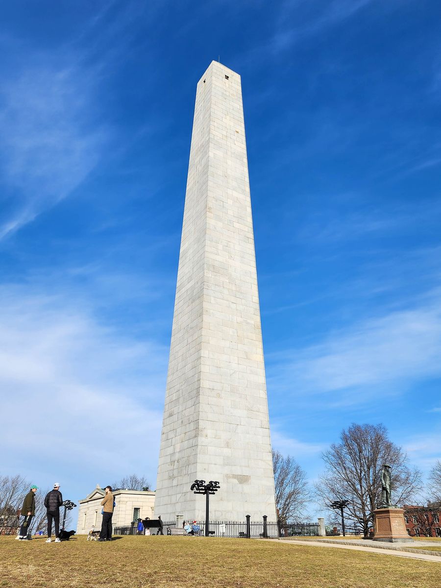
From the Navy Yard, the line leaves the waterfront and climbs through Charlestown’s residential streets of brick and clapboard houses to Monument Square, about 10 to 15 minutes uphill. The 221-foot granite obelisk is free, and its 294 steps have no elevator. The view from the top is worth every one of them.
Getting back
Do not walk back. The MBTA ferry from Pier 4 in the Navy Yard reaches Long Wharf downtown in about ten minutes, and the skyline from the water is the best finish the trail could have; check the schedule and fare at mbta.com, since sailings change by season and are less frequent on weekends. Otherwise, Community College station on the Orange Line is about ten minutes’ walk downhill from the monument. Our guide to getting around Boston covers fares and passes.
Where people lose the line
These are the spots where self-guided walkers most often end up on the wrong street. Knowing them in advance saves ten minutes of confusion.
- Across the Common. The line takes a diagonal path to the State House, but the Common has dozens of paths. If you lose it, simply head uphill toward the gold dome.
- School Street to the Old State House. The line is painted rather than brick in places here, and Downtown Crossing is a working shopping district with construction hoardings, delivery trucks and heavy foot traffic. Three stops in a row are markers or plaques rather than buildings, which makes it easy to miss one. If in doubt, go to the Old State House, which you cannot miss, and pick up the line there.
- The Blackstone Block and the Greenway. Between Faneuil Hall and Hanover Street, the line crosses busy streets and a park. Aim for the far side of the Greenway and the start of Hanover Street.
- North Square. The Revere House is just off Hanover Street, and the line’s detour into the square catches people out. North Square is only a block from Hanover, on the harbor side.
- Leaving the Navy Yard. The line through Charlestown’s streets to the monument is less obvious than downtown. You can always see the top of the obelisk; head for it.
T stops and ways to cut the trail
The subway runs close to the trail along most of its length, which makes it easy to walk only part of it, or to split it over two days.
| Station | Lines | Useful for |
|---|---|---|
| Park Street | Red, Green | The start: Common, State House, Park Street Church, Granary |
| Downtown Crossing | Red, Orange | Old Corner Bookstore, Old South Meeting House |
| State | Orange, Blue | Old State House and the Massacre site, directly above the station |
| Government Center | Green, Blue | Faneuil Hall, King’s Chapel |
| Haymarket | Orange, Green | Faneuil Hall and the walk into the North End |
| North Station | Orange, Green, commuter rail | Copp’s Hill and the walk to Charlestown |
| Community College | Orange | Bunker Hill Monument and getting home |
| Ferry, Navy Yard Pier 4 | MBTA ferry | USS Constitution to Long Wharf downtown |
A subway ride costs $2.40 and you can pay by tapping a contactless card or phone at the gates. An $11 one-day pass pays back after five rides.
Four ways to walk the map
| Plan | Route | Time | Best for |
|---|---|---|---|
| The highlights | Stops 1–11, outside only, finishing at Faneuil Hall | About 1.5 hours | A short first day, or a rainy one |
| The classic | All 16, two or three interiors, lunch in the North End, ferry back | 4–5 hours | Most visitors |
| Two half-days | Day 1: stops 1–11 with the Old State House. Day 2: stops 12–16 with the Revere House and Old North | 2.5 hours each | The best version, if you have the time |
| With young children | Common, Granary, Faneuil Hall, Revere House, Old North, then the ferry from the Navy Yard after the ship | 3–4 hours | Families; skip the bridge by taking the T to North Station |
Our Boston itinerary shows how the trail fits into a longer trip, and our guide to sightseeing tours covers the guided options, including the Freedom Trail Foundation’s own 90-minute walk from the Common.
Restrooms, water and accessibility on the route
- Restrooms. Plan on three reliable stops: the Boston Common Visitor Information Center at the start, Faneuil Hall and Quincy Market in the middle, and the Charlestown Navy Yard near the end. Paid sites generally have facilities for ticket holders. The North End has almost none that are public, so go before you leave Faneuil Hall.
- Water. Fill a bottle at Faneuil Hall. There is nowhere obvious between the Navy Yard and the top of the monument.
- Surfaces. Brick, cobbles and uneven burying-ground paths throughout. Wear shoes with grip, especially when wet.
- Hills and steps. The climbs to the State House, Copp’s Hill and Monument Square are short but steep. The Bunker Hill Monument’s 294 steps have no elevator. Most of the downtown section is manageable with a wheelchair or stroller; the North End’s narrow sidewalks and cobbles are harder, and Copp’s Hill harder still.
- Visual impairment. The Park Service publishes an audio-described Freedom Trail brochure on its maps page.
The map in fall and winter
The route does not change with the seasons, but what you can do along it does, and a few things are worth planning around between October and March.
- Daylight. After the clocks change in early November, it is dark by about 4:30pm. Start by 10am if you want to finish at the monument in daylight, or split the walk over two days.
- Hours. The NPS visitor center in Faneuil Hall runs Wednesday to Sunday from October to Memorial Day, so a Monday or Tuesday walker gets no ranger talks. The State House is closed on weekends all year. The paid sites keep daytime hours; the Old State House and Old South are open daily from 10am to 5pm.
- The ferry. MBTA ferry schedules are reduced outside summer, and weekend sailings are less frequent. Check the timetable before you leave the Navy Yard, or plan on the Orange Line from Community College.
- Weather. The Charlestown Bridge is the coldest, windiest place on the trail in winter, and the bricks get slick in rain and ice. A waterproof jacket with a hood is better than an umbrella. If the day turns wet, our guide to things to do in Boston when it rains sets out an indoor version of the trail.
- America 250. Boston’s 250th-anniversary program runs through 31 December 2026, and several Freedom Trail sites have extra talks and events. Check each site and nps.gov/bost for what is on.
October is the busiest month of the fall, with foliage, school groups and Halloween crowds in the North End on weekends. A weekday morning in early November is about as quiet as the trail ever gets.
Just off the map: worthwhile detours
- The Black Heritage Trail. About 1.5 miles across the north slope of Beacon Hill from the Shaw Memorial opposite stop 2, ending at the African Meeting House of 1806, the oldest surviving Black church building in the country. National Park Service rangers lead it free in season.
- The Boston Tea Party Ships and Museum. On the Congress Street Bridge, ten minutes’ walk south of the Old State House. Timed tickets cost from $36 for adults and $27 for ages 3 to 12. It is an immersive show with costumed actors, which suits some people perfectly and others not at all.
- The Harborwalk. The trail crosses Boston’s 43-mile public waterfront path at the Greenway, and the stretch along the wharves near the Aquarium is a quiet, free break between Faneuil Hall and the North End.
- Beacon Hill. Acorn Street and Louisburg Square are five minutes behind the State House.
What not to bother with
- Paying for a map. The free ones from the visitor centers and the Park Service website are all you need.
- Walking back from Charlestown. Take the ferry. The bridge is the worst part of the trail, and doing it twice is a mistake.
- A hop-on hop-off trolley to “see” the trail. Most stops are best on foot, several are down lanes no bus can reach, and the whole thing is only 2.5 miles.
- The CityPASS for this. It includes nothing on the Freedom Trail. If you want a pass, the $35.10 Boston 250 Pass covers adult entry to the Paul Revere House, the Old State House, Old North Church, Old South Meeting House and King’s Chapel.
Frequently asked questions
Where does the Freedom Trail start and end?
It starts at Boston Common, at the Visitor Information Center at 139 Tremont Street beside Park Street station, and ends at the Bunker Hill Monument in Charlestown. You can walk it in either direction.
Is there a free Freedom Trail map?
Yes. Free printed maps are available at the Boston Common Visitor Information Center and at the National Park Service visitor center in Faneuil Hall, and the Park Service publishes its Freedom Trail map online at nps.gov/bost.
Is the Freedom Trail line continuous?
Yes, from Boston Common to the Bunker Hill Monument. It is mostly a double row of red brick and switches to a painted red line in places, especially across streets. It can be hard to spot in Downtown Crossing and around the Greenway.
How far apart are the Freedom Trail stops?
Most of the first eleven stops are one to four minutes apart on foot. The longer walks are Faneuil Hall to the Paul Revere House, about ten minutes; Copp’s Hill to USS Constitution, 15 to 20 minutes over the Charlestown Bridge; and the Navy Yard to the Bunker Hill Monument, 10 to 15 minutes uphill.
Do I need a map to walk the Freedom Trail?
Not strictly, since the red line leads you all the way. But a map helps at the few spots where the line is hard to follow, and it shows you the T stations if you want to cut the walk short. The free ones are enough.
Can I walk just part of the Freedom Trail?
Yes. The downtown section, stops 1 to 11, is about a mile and takes about an hour and a half at an easy pace. The subway runs close to the whole route, so you can join or leave at Park Street, State, Government Center, Haymarket, North Station or Community College.
The map gets you from stop to stop; deciding which stops deserve your time and money is another question. Our guide to the Freedom Trail stops reviews all sixteen with what is inside, what it costs and an honest verdict on each.
The walking times above add up to little more than an hour, but the stops are where the day really goes. Our guide to how long the Freedom Trail takes sets out realistic times for each stop, what adds time without warning, and ready-made schedules for every kind of visit.
Stop two, the State House, is open on weekdays only, and its free guided tours have to be booked ahead. Our guide to the Massachusetts State House tour covers the phone booking, the Beacon Street entrance and the rooms the tour takes in.
Boston’s 250th anniversaries ran from the Massacre in 2020 to the evacuation and the Declaration in 2026, and the sites on this map marked each one. Our guide to America 250 in Boston explains what happened, what is still on, the Boston 250 Pass, and the annual anniversaries worth timing a visit around.