Boston is not a city of great heights. It has a handful of skyscrapers, a few hills that have been shaved down over the centuries, and one observation deck worth the name. What it has instead is water on three sides — the harbor, the Charles, the inner channels — and that changes where the views are. The best views in Boston are mostly from across the water, looking back at the city, and a surprising number of them cost nothing more than a subway fare.
This guide covers the viewpoints worth your time: from the top of towers and monuments, from parks on the far side of the harbor and river, from the water itself, and at street level. For each, it says what you see, what it costs, when to go and how to get there. Prices and access details were checked in September 2026; several of these places are seasonal or run on limited hours, so confirm before you travel.
The best views at a glance
| Viewpoint | Type | Cost | Best time |
|---|---|---|---|
| View Boston, Prudential Tower | Observatory, 52 floors | $37 with fee | Sunset into night |
| Piers Park, East Boston | Harborfront park | Free | Sunset and after dark |
| Longfellow Bridge | Bridge over the Charles | Free | Late afternoon |
| Harvard Bridge (Mass Ave) | Bridge over the Charles | Free | Sunset |
| Bunker Hill Monument | Granite obelisk, 294 steps | Free | Clear mornings |
| Dorchester Heights Monument | Restored memorial tower | Free | On open days |
| Washington Tower, Mount Auburn Cemetery | Hilltop tower, about 100 steps | Free | October |
| Independence Wharf | 14th-floor deck | Free | Weekday daytime |
| Custom House Tower | 26th-floor balcony | Free, by reservation | Scheduled visit |
| MBTA ferry, Long Wharf–Charlestown | Commuter boat | Standard ferry fare | Any clear day |
| Castle Island, South Boston | Waterfront park and fort | Free | Sunrise |
| North Point Park, Cambridge | Riverside park | Free | Dusk, for the Zakim Bridge |
From above
View Boston, Prudential Tower
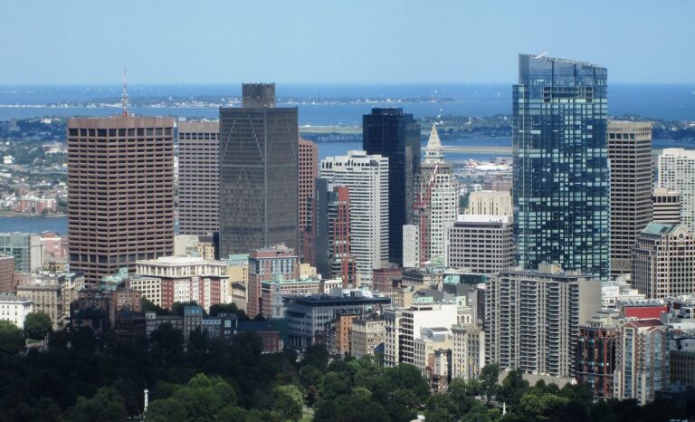
If you want to see all of Boston at once, this is the only place to do it. The observatory across the top three floors of the Prudential Tower has floor-to-ceiling windows on the 52nd floor and an open-air roof deck, the Cloud Terrace, on the 51st — the only outdoor viewpoint at that height in the city. Because the Pru stands on its own in Back Bay, a mile or so west of the Financial District, you look at the downtown skyline rather than out from the middle of it, with the Charles, Fenway Park and the harbor all in view.
General admission is $34 plus a $3 booking fee, open daily 10am to 10pm with last entry at 9:15pm, and it is one of the choices on the Boston CityPASS. Go about 45 minutes before sunset and stay until the lights come on. Our full guide to the View Boston observation deck covers the three floors, what you can see in each direction and when not to bother.
Bunker Hill Monument, Charlestown
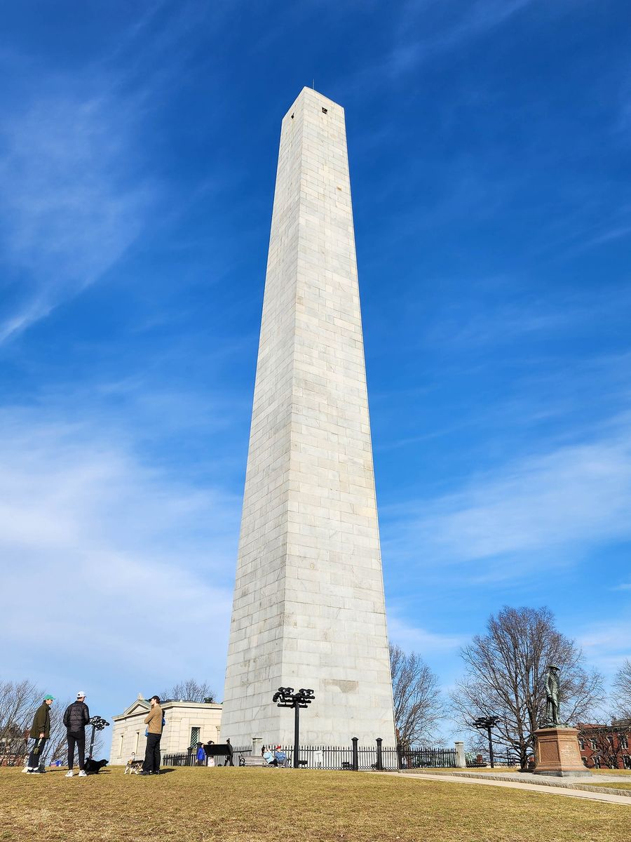
The 221-foot granite obelisk at the end of the Freedom Trail marks the first major battle of the Revolution, fought in June 1775. It is free, run by the National Park Service, and you can climb its 294 steps to the small observation room at the top. There is no elevator.
Be honest with yourself about the reward. The windows at the top are small, and you look through them rather than out over a parapet. What you get is a view over the rooftops of Charlestown, the Navy Yard, the harbor, the Zakim Bridge and downtown, and the satisfaction of the climb. It is worth doing once, as part of the trail. It is not worth a special trip for the view alone.
Dorchester Heights Monument, South Boston
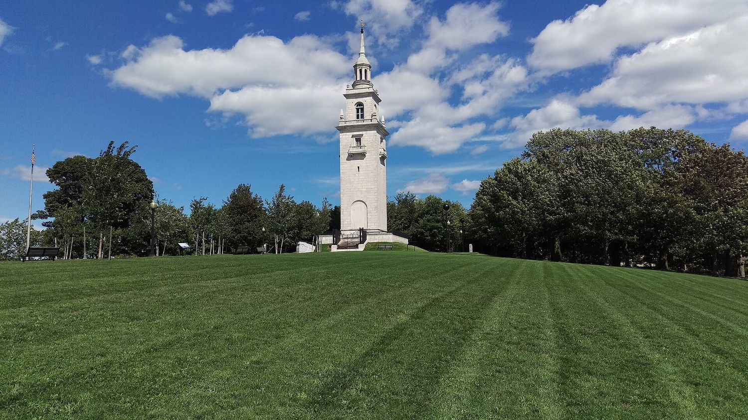
This is the viewpoint most visitors have never heard of, and it has just had a new lease of life. In March 1776, George Washington’s army hauled cannon captured at Fort Ticonderoga onto these heights overnight, and the British, suddenly overlooked by guns, evacuated Boston on 17 March — a date the city still marks as Evacuation Day. The white marble tower on the hilltop commemorates it.
The National Park Service carried out a major restoration of the monument, funded under the Great American Outdoors Act, and the site was rededicated on 17 March 2026 for the 250th anniversary of the evacuation. Visitors can now climb the restored tower for views over South Boston, the harbor and the downtown skyline. The monument is free; opening days and times for the climb are set by the park, so check nps.gov/bost before you go. Even when the tower is closed, the lawn of Thomas Park on the hilltop is a lovely spot with a view.
Washington Tower, Mount Auburn Cemetery, Cambridge
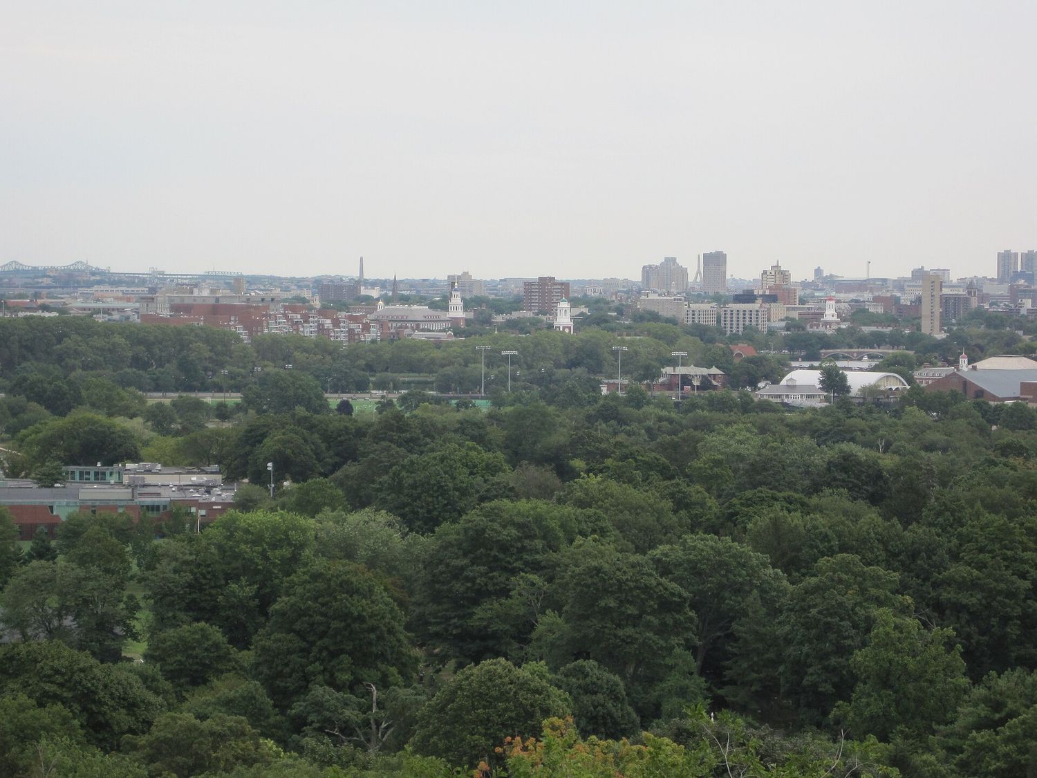
Mount Auburn Cemetery, founded in 1831, was the first garden cemetery in America: 175 acres of rolling, wooded hills on the Cambridge–Watertown line, where Henry Wadsworth Longfellow, Isabella Stewart Gardner, Winslow Homer and Mary Baker Eddy are buried. On its highest point stands the Washington Tower, a small granite tower you can climb — about a hundred steps up a steep spiral staircase — for a free 360-degree view. East is the skyline of Boston over the treetops and the steeples of Harvard; north, the hills of Somerville; west, the Arlington ridge.
In October, with the cemetery’s trees turning, this is the best foliage view in the Boston area, bar none. The tower is open seasonally and within cemetery hours, which change through the year; check mountauburn.org before you go. Bus 71 or 73 from Harvard Square runs along Mount Auburn Street to the main gate. See our Cambridge and Harvard guide for the rest of the area.
Great Blue Hill, Blue Hills Reservation
For the longest view in the region, head south of the city to the Blue Hills Reservation, a state park of wooded hills about ten miles from downtown. Great Blue Hill, at 635 feet, is the highest point in the Boston area, and the stone Eliot Tower on its summit gives you the whole of Boston laid out on the horizon to the north, with the harbor and, on a clear day, the ocean beyond. It is free, and the climb to the summit is a proper hike of half an hour or so up rocky trails.
The honest drawback is access. Without a car it is awkward to reach, and even with one you should expect busy parking on fall weekends. If you have a car and a free morning, and you want a view with some hiking attached, it is the best half-day outing on this list. If you are relying on the T, stick to the viewpoints in the city.
Independence Wharf and the Custom House
Two free downtown viewpoints are worth knowing about. Independence Wharf, at 470 Atlantic Avenue, has a 14th-floor observation deck open to the public, generally in office hours, with views over the harbor and the airport; show photo ID at the lobby desk. The Custom House Tower, now Marriott’s Custom House, has a small open-air balcony on its 26th floor. Visits are free but must be reserved through the hotel’s front desk, and there is usually only one scheduled visit a day. The Custom House was the tallest building in Boston from 1915 until the Pru was finished in 1964, and its balcony has the most old-fashioned view in the city.
From across the water
Piers Park, East Boston
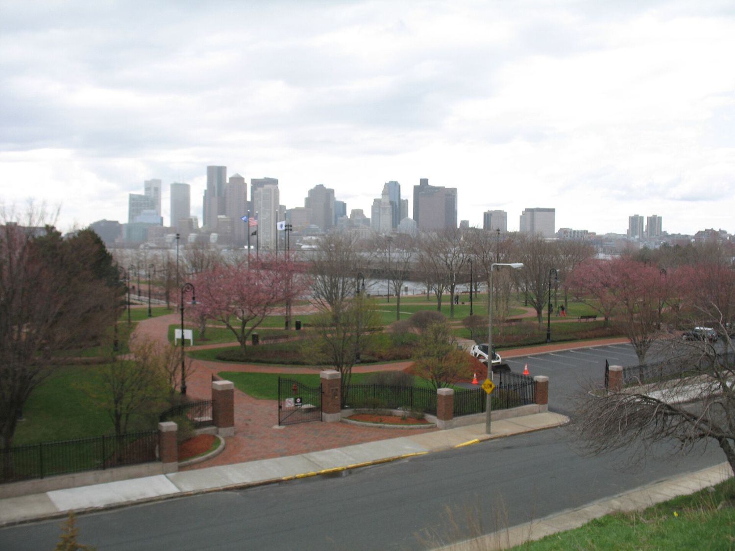
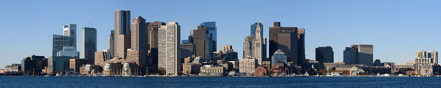
If we had to pick one free view, it would be this one. Piers Park, run by Massport on the East Boston waterfront, stretches out on an old pier facing the downtown skyline directly across the inner harbor, and at sunset, with the light behind you turning the towers gold, it is spectacular. After dark the whole skyline is lit up and reflected in the water. It is quiet, it is free, and very few tourists know about it. Massport reopened the park’s renovated playground and splash pad in June 2026, so it is a good spot for families too.
Take the Blue Line to Maverick, then walk about ten to fifteen minutes to the waterfront. On the way you pass LoPresti Park, another small harborside park with a similar view, and the East Boston section of the Harborwalk links the two. Stay for dinner in East Boston afterward; the neighborhood has some of the best, and least touristy, food in the city.
The Longfellow Bridge
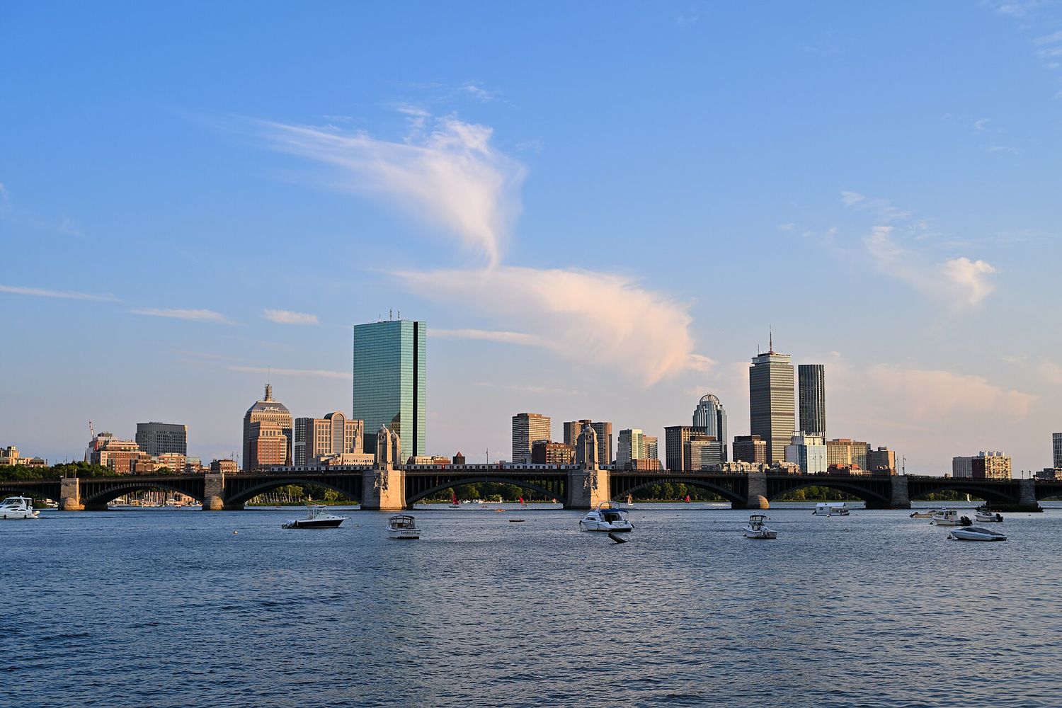
The granite bridge that carries the Red Line over the Charles between Beacon Hill and Kendall Square is nicknamed the “salt and pepper bridge” for the shape of its four central towers. It was fully rebuilt between 2013 and 2018, with wide sidewalks and viewing bays. Walk across it in the late afternoon and you get the Charles River basin in both directions: Back Bay’s towers upstream, the Museum of Science and the Zakim Bridge downstream, and Beacon Hill rising behind you. The Red Line rattles past in the middle, which is part of the charm. From Charles/MGH station, you can be on the bridge in two minutes.
The Harvard Bridge (Mass Ave)
Upstream, the long, low bridge carrying Massachusetts Avenue from Back Bay to MIT has the best sunset view on the river. Face west and the sun goes down over Cambridge and the Charles; turn around and the Back Bay skyline glows. Look down at the sidewalk as you cross: the painted marks count the bridge’s length in “smoots”, after an MIT student, Oliver Smoot, whose fraternity brothers laid him end to end across it in 1958. The bridge is 364.4 smoots long, plus or minus an ear.
The Cambridge bank of the Charles
The best view of Back Bay is from Memorial Drive on the Cambridge side of the river. The Esplanade gets the crowds; the Cambridge bank gets the skyline, with the towers of the Hancock and the Pru reflected in the basin and sailboats in between. On summer Sundays, part of Memorial Drive is closed to cars and opened to walkers and cyclists. On the Fourth of July, the Cambridge bank is the classic alternative to the packed Esplanade for watching the fireworks over the river.
North Point Park, Cambridge
Tucked beside the Charles near Lechmere station, this small modern park has the best close view of the Zakim Bridge, the cable-stayed bridge that carries I-93 over the river. Opened in 2003, its twin towers were designed to echo the Bunker Hill Monument, and at night it is lit up, often in blue. Come at dusk.
Castle Island, South Boston
At the tip of South Boston, Castle Island is a park built around Fort Independence, a granite fort from the nineteenth century on a site that has been fortified since the 1600s. A paved loop around the island and the causeway called the Sugar Bowl give you a wide view out to the harbor islands, the airport and the planes coming in low over the water. It faces east, which makes it a sunrise spot. Sullivan’s, the seasonal snack stand, has served hot dogs and fried clams here for generations. Getting there without a car takes a bus from Broadway on the Red Line; check routes on mbta.com.
Christopher Columbus Waterfront Park
On the harbor between the North End and the Aquarium, Columbus Park has a long wooden trellis, the Rose Kennedy Rose Garden and a waterfront promenade looking out over the inner harbor to Charlestown and East Boston. It is right on the way between the North End and the waterfront attractions, which makes it the easiest harbor view in the city to fit into a day — and the best place to eat a cannoli from Hanover Street with the water in front of you.
The Charlestown Navy Yard
After you have seen USS Constitution, walk out to the end of the piers in the Navy Yard. You look back across the harbor to the North End, with Old North Church’s steeple among the rooftops, and the downtown towers behind — a view that puts the Freedom Trail’s two ends in the same frame. The Harborwalk runs along the water here, and the MBTA ferry to Long Wharf leaves from Pier 4.
From the water
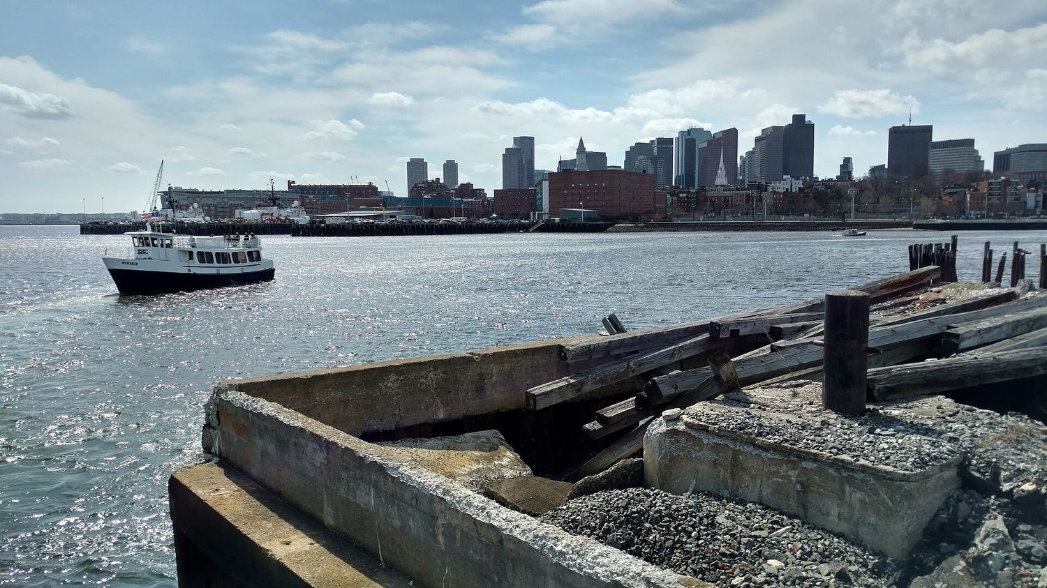
The MBTA ferry to Charlestown
The best-value view in Boston is on a commuter boat. The MBTA ferry between Long Wharf and the Charlestown Navy Yard takes about ten minutes and costs a standard ferry fare, and for those ten minutes you have the downtown skyline, the harbor and the Navy Yard all around you. Take it one way on the Freedom Trail — walk to Charlestown, see USS Constitution, and ride back to Long Wharf. The ferry accepts contactless cards, and under the MBTA’s two-hour transfer pilot that began on 1 September 2026, it can be combined with the subway or a bus on the same payment method.
The Harbor Islands ferry
For the full harbor, take the ferry to Georges Island from Long Wharf North: $25 round trip for adults and $18 for children aged 3 to 11. The crossing shows you the whole harbor, the airport and the skyline shrinking behind you, and Fort Warren on the island has its own views back to the city. The season is short, though: the last public ferries of 2026 run over Indigenous Peoples’ Day weekend, 10–12 October, and service resumes in mid-May. Our guide to Boston Harbor and the islands has the details.
The Charles by Duck
The twenty minutes a Boston Duck spends on the Charles give you the Back Bay skyline from the middle of the river, which no walking route can match. At about $62 an adult with fees, it is an expensive way to get that view, but for families it can be worth it. See our guide to Boston Duck Tours.
Street-level views worth finding
Not every great view in Boston needs height or water. A few of the best are at street level, and you will pass most of them anyway.
- Acorn Street, Beacon Hill. The narrow cobbled lane of brick row houses is the most photographed street in the city. Go early in the morning, before the crowds, and be respectful: people live here.
- The State House from the Common. Stand on the path across Boston Common from the Shaw Memorial and look up the hill at the gold dome, especially in low afternoon light.
- The lagoon bridge in the Public Garden. The view along the lagoon, with willows and the Swan Boats in season, is the classic Boston postcard. Our Swan Boats guide covers the Garden.
- The Christian Science Plaza. The long reflecting pool, with the Mother Church dome at one end and the Prudential Tower reflected in the water, is one of the most striking modern urban spaces in the city.
- The Old State House among the towers. The 1713 brick building surrounded by glass skyscrapers, at the corner of State and Washington Streets, is the most dramatic collision of old and new Boston.
- Commonwealth Avenue in spring. In April, the magnolias in the front gardens of the Back Bay brownstones make this one of the prettiest streets in the country.
Best views by time of day
| Time | Where to be | Why |
|---|---|---|
| Sunrise | Castle Island | Faces east over the harbor |
| Morning | Acorn Street, the Public Garden | Soft light, no crowds |
| Midday | Independence Wharf, the MBTA ferry | Clear harbor views; daytime access |
| Late afternoon | Longfellow Bridge, Cambridge bank | Low sun on the Back Bay skyline |
| Sunset | Piers Park, the Harvard Bridge, View Boston | Gold light on downtown; sunset over the Charles |
| Night | Piers Park, North Point Park, View Boston | The lit skyline and the Zakim Bridge |
Best views by season
- Fall: the best season for views. Clear air, comfortable temperatures and, from mid-to-late October, foliage — go to the Washington Tower at Mount Auburn, the Public Garden and the Esplanade.
- Winter: the clearest air of the year, and snow on the Common and the Public Garden. The waterfront parks are raw, so dress for the wind.
- Spring: magnolias on Commonwealth Avenue, tulips in the Public Garden, and blossom at Piers Park.
- Summer: long evenings, sailboats on the Charles, and the Fourth of July fireworks over the river. Haze can soften the long views.
For the weather month by month, see our guide to the best time to visit Boston.
Photography tips
- Stay for blue hour. The twenty to thirty minutes after sunset, when the sky is deep blue and the city lights are on, is when the Boston skyline photographs best. Most people pack up too early.
- Put the water in the foreground. Almost every great Boston skyline shot has the harbor or the Charles in front of it. Get low to the water at Piers Park or on the Cambridge bank for reflections.
- Use a longer lens across the harbor. From East Boston, the downtown towers are about a mile away; a zoom compresses them into a dramatic wall of buildings.
- Shoot through glass carefully. At View Boston, press the lens against the window and shade it with your hand or a jacket to kill reflections. Or go out on the Cloud Terrace, where there is no glass at all.
- Go early for Acorn Street and the Public Garden. Before 8am you will have them almost to yourself.
- Watch the wind. On the bridges and the waterfront, the wind off the water is stronger than you expect and makes long exposures difficult without a steady support.
What isn’t worth it
- Paying for a harbor cruise just for the view. The MBTA ferry to Charlestown gives you most of it for a fraction of the price.
- Rooftop bars as viewpoints. Several hotels have rooftop bars with good views, but you are paying for expensive drinks and usually a line to get in. If the view is what you want, Piers Park is free and the view is better.
- Climbing Bunker Hill just for the view. Do it for the history and the climb; the small windows at the top limit the view.
- Going up anything in low cloud. Check the top of the Prudential Tower from the street before buying a View Boston ticket.
- The top deck of a hop-on hop-off bus. You see the city at the level of the second floor of a building, in traffic.
A sunset-to-night route
For one evening that takes in the best free views in the city:
- Late afternoon: walk across the Longfellow Bridge from Charles/MGH toward Cambridge and back.
- An hour before sunset: take the Red Line from Charles/MGH to Park Street, the Green Line one stop to Government Center, and the Blue Line under the harbor to Maverick in East Boston.
- Sunset: walk to Piers Park and watch the skyline light up across the harbor.
- Dinner: eat in East Boston, among the neighborhood’s pizza places and taquerias.
- Night: Blue Line back downtown, ten minutes.
Total cost: a few subway fares and dinner. For another version aimed at couples, see our guide to romantic Boston.
Best views in Boston: frequently asked questions
Where is the best view of the Boston skyline?
For the downtown skyline, Piers Park in East Boston, across the harbor, especially at sunset and after dark. For Back Bay, the Cambridge bank of the Charles. For the whole city at once, View Boston at the top of the Prudential Tower.
Is there a free observation deck in Boston?
Yes. Independence Wharf’s 14th-floor deck at 470 Atlantic Avenue is free with photo ID, and the Custom House Tower’s 26th-floor balcony is free by reservation. The Bunker Hill Monument and the restored Dorchester Heights Monument are also free to climb.
How much does View Boston cost?
As of September 2026, $34 for adults plus a $3 booking fee per ticket. It is included in the Boston CityPASS.
Can you climb the Bunker Hill Monument?
Yes. It is free, with 294 steps and no elevator, and run by the National Park Service. The windows at the top are small.
Where is the best place to watch the sunset in Boston?
The Harvard Bridge over the Charles for the sun going down over the river, or Piers Park in East Boston for the skyline turning gold in the last light.
Where can I see the Zakim Bridge lit up?
North Point Park in Cambridge, near Lechmere station, has the best close view, especially at dusk.
What is the best view for fall foliage in Boston?
The Washington Tower at Mount Auburn Cemetery in Cambridge, looking over 175 acres of trees, from mid-to-late October. Check the cemetery’s website for tower access before you go.
Is Piers Park worth the trip?
Yes. It is a short Blue Line ride from downtown to Maverick and a ten-to-fifteen-minute walk, it is free, and it has the best harbor view of the downtown skyline.
For a view that most visitors never see, climb Peters Hill in the Arnold Arboretum, where the downtown skyline rises above miles of treetops. It is one stop on a longer walk: our guide to the Emerald Necklace in Boston links it with Jamaica Pond and the Back Bay Fens, all free and all on the T.